2014/06/30 — Monday — Voltage Regulator

Joel and Jim worked night shift this weekend and had today off,  so I hitched a ride with Paul.

Mike ordered a replacement regulator from E-bay for the standby diesel power plant.  Until it arrives and without a working regulator, there will be no broadcasts in the event of a power failure.  With this prospect and since Jim and Joel were not here to work on connecting the antenna switches, I decided to see if there was any possibility of repairing the failed regulator.

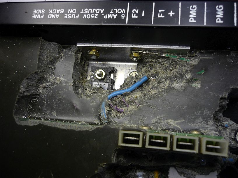
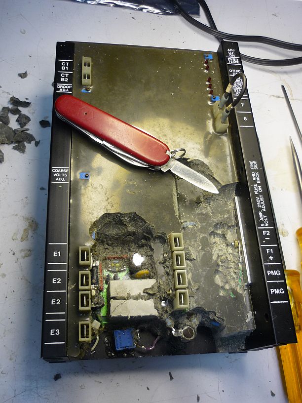
Someone had already begun to chip away at the potting material, but I figured the most likely failure might be in the higher current circuits, probably on the right side of the voltage regulator.

Someone had already begun to chip away at the potting material around what looked like the sensing circuitry, but I figured the most likely failure might be in the higher current circuits, probably on the right side of the voltage regulator.  After removing the first layer, an extra heat sink began to appear.

After shifting into 'archeological dig' mode, the first power device was exposed.

After shifting into ‘archeological dig’ mode, the first power device was finally exposed.

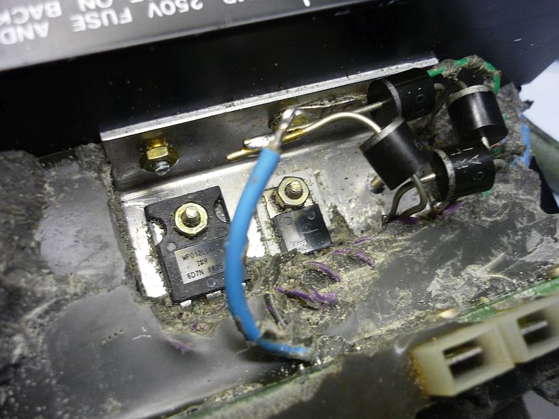
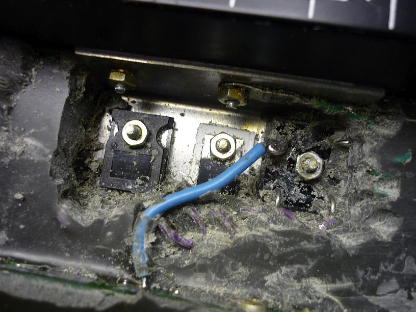
Eventually, three power devices were 'unearthed' that were attached to the heat sink.  The two on the left tested OK, but the rectifier bridge on the right had a dead short on one of its four diodes.

Eventually, three power devices were ‘unearthed’ that were all attached to the extra heat sink. The two on the left tested OK, but the rectifier bridge on the right had a dead short on one of its four diodes.

The faulty bridge was successfully removed and replaced with four discrete diodes.

The faulty bridge was successfully removed and replaced with four discrete diodes.

After the ‘repair’ was completed, we had just enough time to install and test the regulator in the standby power plant.  Unfortunately, the regulator’s 5 amp fuse blew immediately!  Now when we checked, the diodes were OK, but the other two power devices had both failed.  Our attempt was not successful, but at least we tried!


2014/06/29 — Sunday

Before church, we made our Sunday morning Skype phone call to Mom, followed by a Skype video call to Allan’s family.  Today there was a bonus — Nathan and Rachel were there, too.

We got a few photos of the service at Harvest Baptist Church Guam:

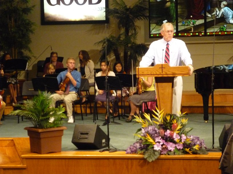
Harvest Baptist Church had a patriotic service this morning, since Independence Day is coming up on Friday.  We estimate that the auditorium and balcony can hold about 500 people.  Jack Marlowe is the tall man on the left side of the aisle.  Virginia is to the right of the photo.

Harvest Baptist Church had a patriotic service this morning, since Independence Day is coming up on Friday. We estimate that the auditorium and balcony can hold about 500 people. Jack Marlowe is the tall man on the left side of the aisle. Virginia is to the right in the photo.

The pastor is Marty Herron.  The orchesta is mostly violins with a cello and flute and piano accompaniment.

The senior pastor at Harvest Baptist is Marty Herron. The orchestra consists mostly of young people with violins, a cello and flute accompanied by a piano.

After church, we were given another office chair to take to the transmitter site.  We stopped by Wendy’s for a quick lunch.  Another missionary gave Virginia a great idea — order a chicken wrap meal with chili on the side, then take the chili home to use on a baked potato — so that’s what we did!

Since Cost U Less is next to Wendy’s, we picked up a few things there, then drove over Nimitz Hill to get some photos that we wanted for yesterday’s blog.  We weren’t able to take them yesterday because of rain.

We made two more stops on the way home.  First at Payless Supermarket to get some frozen items, since it is within minutes of home, then at the Water Store to quickly fill two 5-gallon jugs with drinking water.

After a short nap, the rest of the evening was spent doing several days worth of blogs.


2014/06/28 — Saturday PM — Sella and Cetti Bay

After the morning hike, we made a quick stop by Taco Bell for a bite to eat, then home.  Both of us took a nap.

While we slept, there was quite a downpour and we were glad that we were not hiking in the middle of it!
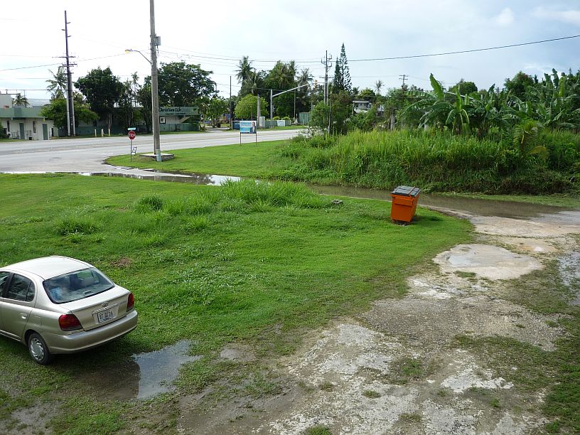
We can use our side street as a rain gauge.  If it is completely covered, like this, we know there has been more than 1/2 inch of rain.

We can use our side street as a rain gauge. If it is completely covered, like this, we know there has been more than 1/2 inch of rain.

Below are photos of our late afternoon trek:
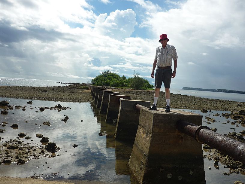
We started driving south of our apartment. Our first stop, after about 1/2 mile, was to investigate the pipeline near Agaan Point. Judging from the pipe joints, it used to be a waste-water line dumping outside the reef. Note — this is the first day that Larry has worn shorts in years. Can you tell??!!

About a mile further south, we stopped at Nimitz Beach Park. TWR plans to have its 4th of July picnic at one of the pavilions.
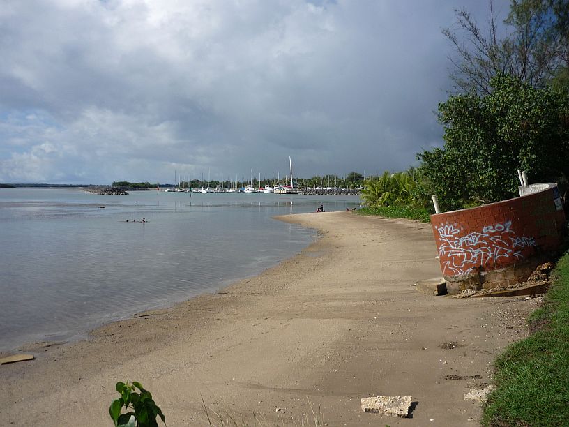
About a mile further south, we stopped at Nimitz Beach Park. TWR plans to have its 4th of July picnic at one of the pavilions.

Looking north from Nimitz Beach Park at the Agat Marina.  The shower on the beach has been effected by erosion.

Looking north from Nimitz Beach Park at the Agat Marina. The shower on the beach (at right) has been effected by erosion.
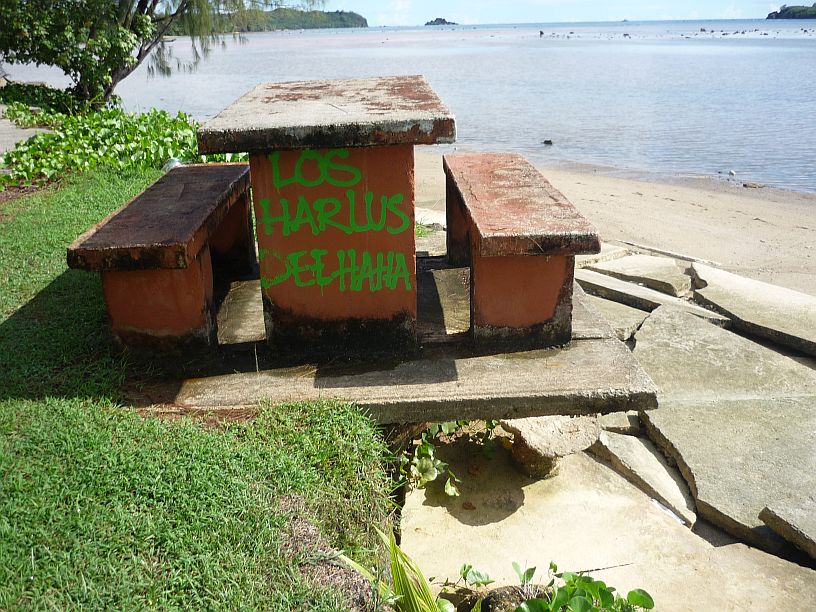
More signs of erosion at Nimitz Beach Park.  Which side of this picnic table to you want to sit on?

More signs of erosion at Nimitz Beach Park. Which side of this picnic table would you want to sit on?
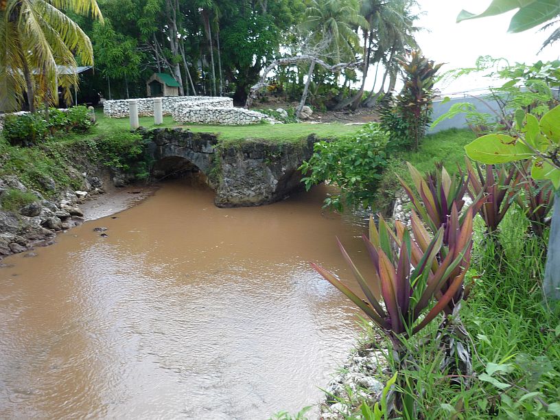
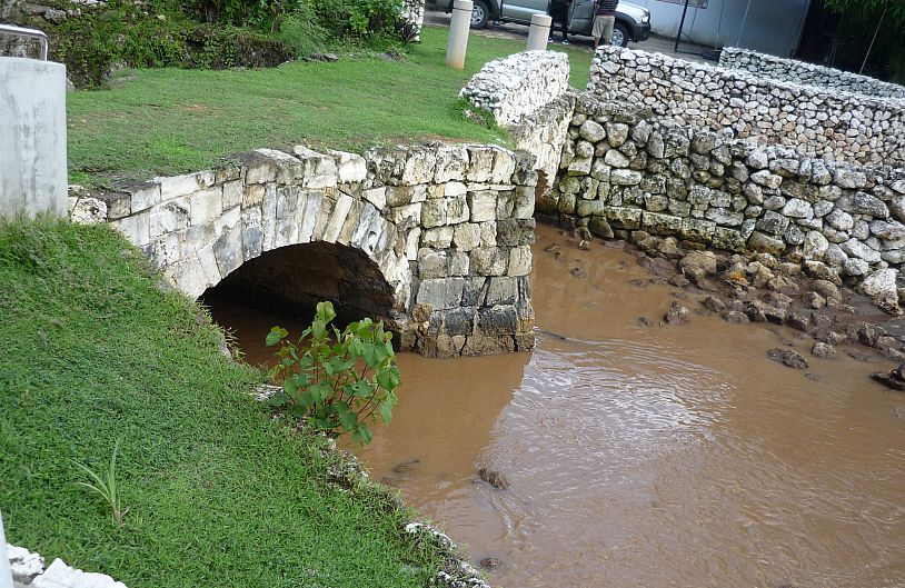
Talaifak Bridge is about 1/10 mile south of Nimitz Beach Park.  This waterway's outlet into the Philippine Sea is less than 100 yards beyond the bridge.

Talaifak Bridge is about 1/10 mile south of Nimitz Beach Park. This waterway’s outlet into the Philippine Sea is less than 100 yards on the other side of the bridge.
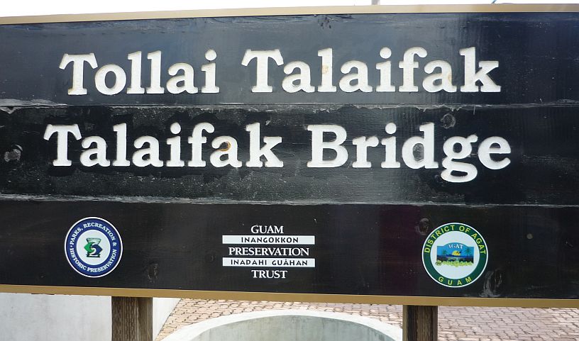
140628P -- TalaifakBridgeSign140628P -- TalaifakBridgeSign2

The downstream side of Talaifak Bridge.
The downstream side of Talaifak Bridge.

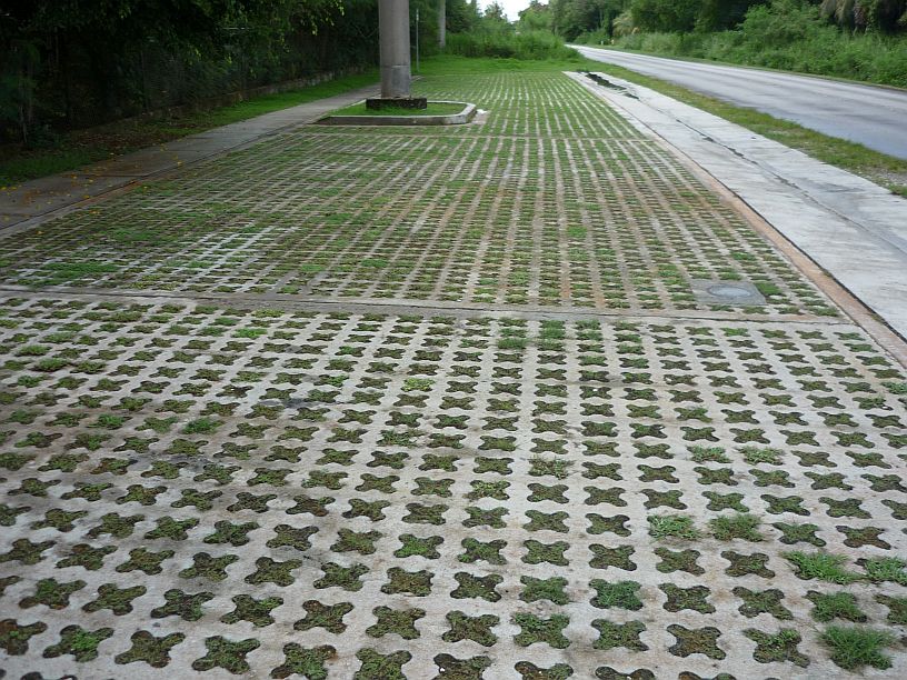
The parking area at Talaifak Bridge was unusual.  The open pattern in the surface allows most of the rain water to seep into the soil rather than running off and causing drainage problems

The parking area at Talaifak Bridge was unique The open pattern in the concrete surface allows most of the rain water to seep into the soil thus lessening drainage problems.
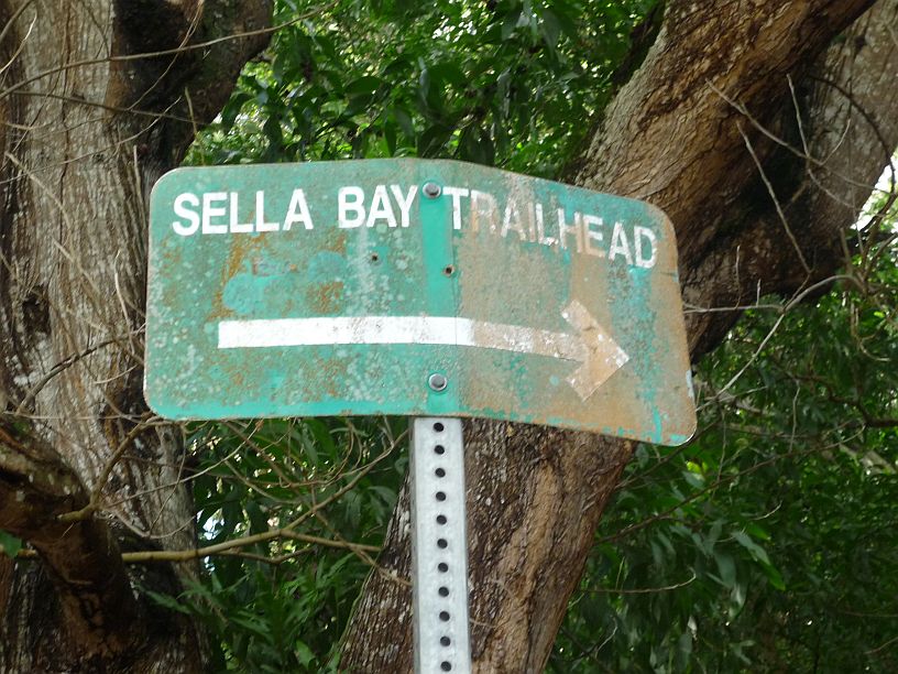
Our next stop, Sella Bay Trailhead, is about 5 miles south of our apartment.  The condition of the sign should have been a forewarning of what was ahead!

Our next stop, Sella Bay Trailhead, is about 5 miles south of our apartment. The condition of the sign should have been a forewarning of what was ahead!
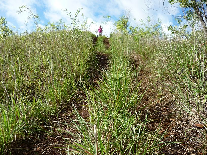
Most of the trail was a very old 4-wheel drive track.  Since it had just rained a couple hours earlier, the tracks were slippery mud and the grass was too high to walk in.  The steep slopes like this one were extra tricky.

Most of the trail was a very old 4-wheel drive track. Since it had just rained a couple hours earlier, the tracks were slippery mud and the grass was too high to walk in. Steep slopes like this one were especially tricky to transverse.
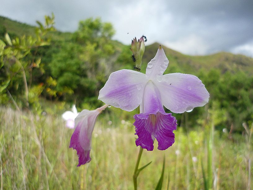
We saw thousands of these wildflowers on this hike and the one this morning.  Are they wild orchids?  We've heard them called this, but cannot find a scientific source to verify it.

We saw thousands of these wildflowers on this hike and the one this morning. Are they wild orchids? We’ve heard them called this, but cannot find a scientific source to verify it.

Across the valley from this trail is the SDA shortwave transmitting site.
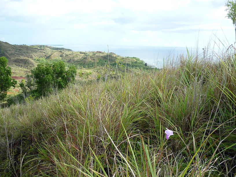
Across the valley north of this trail is the SDA shortwave transmitting site.

After about 45 minutes of hiking we could see Sella Bay in the distance, just above the wild orchid in the photo.  It was at this point that we decided to turn back as there would be now way to make it down and back before sundown.

After about 45 minutes of hiking we could see Sella Bay in the distance, just above the wild orchid in the photo. It was at this point that we decided to turn back as there would be no way to make it down and back before sundown.
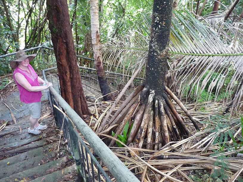
At the Sella Bay Trailhead, there were some steps up to an overlook.  We had not gone to the overlook earlier because a wedding party was there.  The tree with the unusual roots is a pandanus palm.

At the Sella Bay Trailhead, there were some steps up to an overlook. We had not gone to the overlook earlier because a wedding party was there. The ‘tree’ with the unusual roots is a pandanus palm.
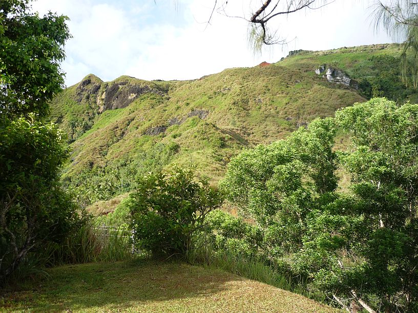
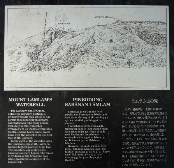
From the overlook it is possible to see the highest peak in Guam -- Mount Lamlam.  It is the peak on the right.  Between the twin peaks on the left is a rock face which is a waterfall after heavy rains.  So far, we haven't seen the waterfall.

From the overlook it is possible to see the highest peak in Guam — Mount Lamlam at 1,332 feet. It is the peak on the right. Between the twin peaks on the left is a rock face which which turns into a waterfall after heavy rains. So far, we haven’t seen the waterfall.
140628P -- LamlamSign

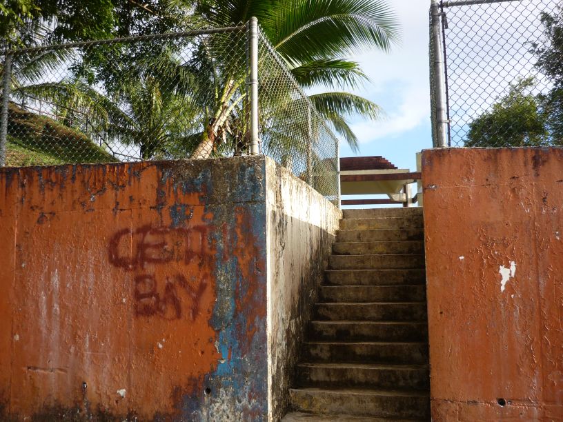
About a mile further south is the Cetti Bay overlook with a rather 'plain' entrance from the road.

About a mile further south is the Cetti Bay overlook with a rather ‘plain’ entrance from the road.
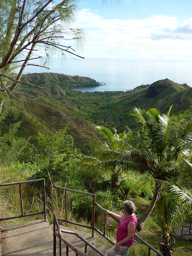
The view of Cetti Bay is a definitely better than the entrance!

The view of Cetti Bay is definitely better than the entrance!
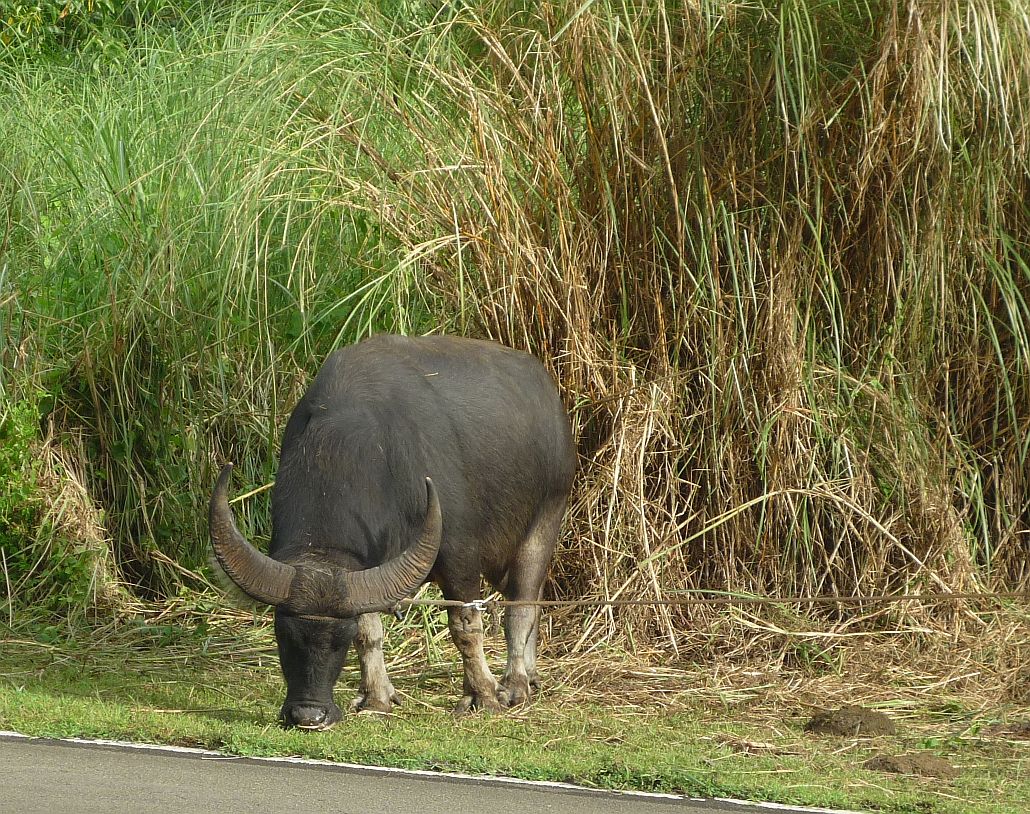
On the road home we encountered this large carabao (pronounced ‘care’ a ‘bow’ [like ‘bow down’]). Fortunately, it was tied up, as are most carabao grazing by the road. They are huge and if hit by a car, which occurs most often at night, the car suffers by far the most damage!

Our last stop was at the unusual MacDonalds in Agat that we mentioned in a previous blog.  We ordered from the typical $1 menu, not their special Guam high calorie Spam breakfast menu!

Our last stop was at the ‘MacDonalds in a container’ at Agat that we mentioned in a previous blog. We ordered from their three item $1 menu, not their special Guam high calorie Spam breakfast menu!
 

2014/06/28 — Saturday AM — Hike to Korean Flight 801 Crash Site

First thing on the agenda this morning was to have a puncture repaired on the right front tyre of the Highlander.  It has had a slow leak for some time and the cause was finally traced to a screw that appears to have been there for quite some time.  About 15 minutes and $15 later, we were on the road again.

We decided to try to hike to the crash site of Korean Airlines flight 801 which occurred 6 August 1997 on Nimitz Hill not far from TWR’s AM station.  Although not allowed help with the rescue, TWR personnel did help with supplying food, drink and other ‘encouragement’ to the rescuers.

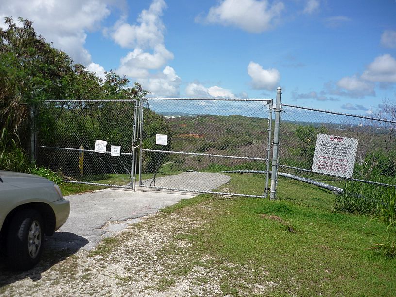
The easy way to the crash site -- since the site is on federal property, this gate is opened only on the anniversary date (6 August) each year for relatives to visit the crash site.

The easy way to the crash site is by car on this road — note the pipe line on the right side of the road.  Since the site is on federal property, this gate is opened only on the anniversary date (6 August) each year for relatives to visit the crash site.

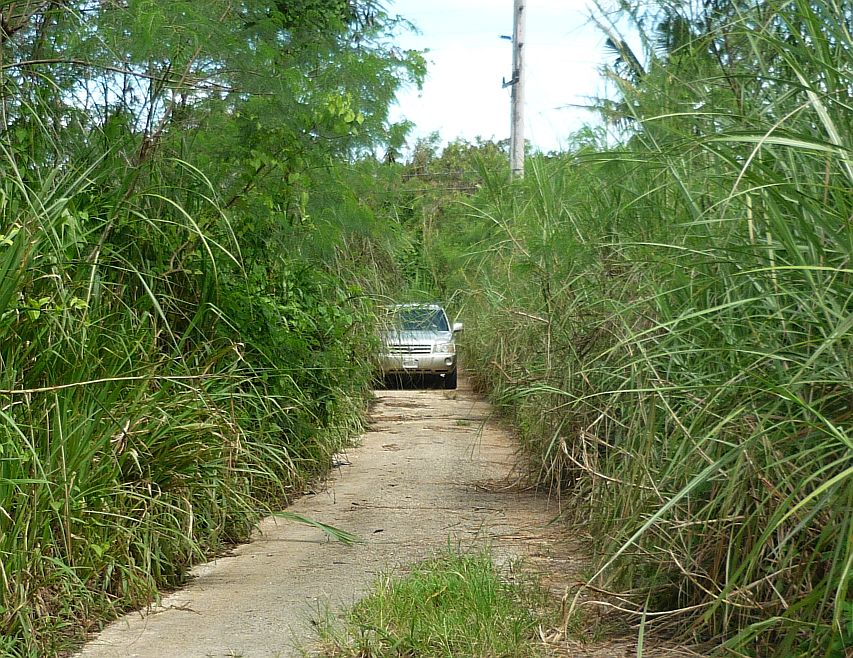
We were told that we were allowed to hike to the site.  There is narrow vehicle path about 1/4 mile NW of the gate that allows access to a power line right of way.

We were told that we were allowed to hike to the site. There is narrow vehicle path about 1/4 mile NW of the locked gate that allows access to a power line right-of-way.

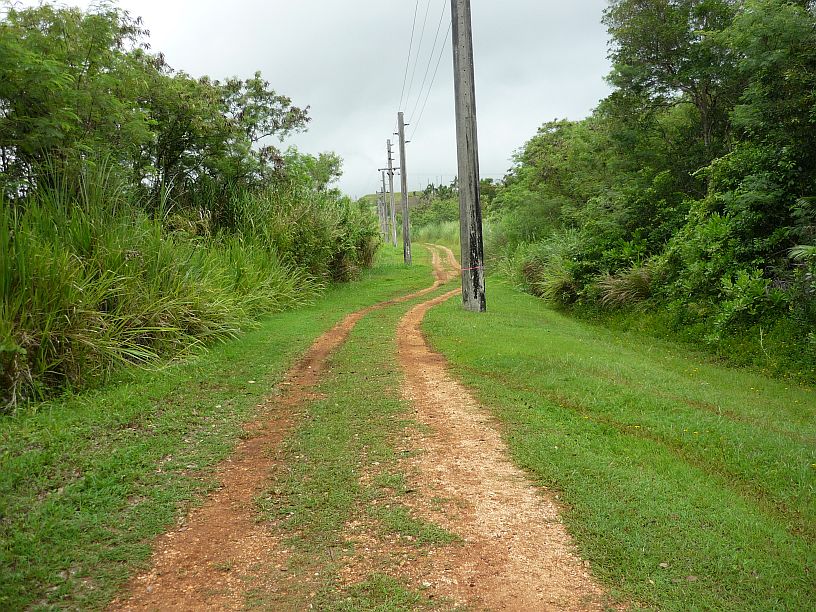
We followed the power line that has concrete poles.

We followed this power line that has concrete poles.

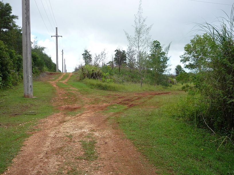
After traveling NW for a little over 1/10 mile we took the track to the right that follows another power line with wood poles.

After traveling north-west for a little over 1/10 mile we took the track to the right that follows another power line with wooden poles.

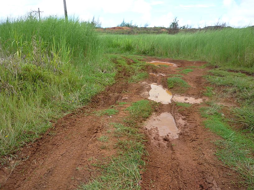
Immediately after the right turn, we encountered this mud hole and decided to walk from here.  Obviously, some other vehicles, probably 4-wheel drive, had gone through.  We did not want to get stuck, nor have to wash a very muddy car!  Also, we did not know the consequences of being found in a restricted area with a vehicle.  We knew that hiking in was allowed.
Immediately after the right turn, we encountered this mud hole and decided to walk from here. Obviously, some other vehicle, probably 4-wheel drive, had gone through. We did not want to get stuck, nor have to wash a very muddy car! Also, we did not want to find out the consequences of being found in a restricted area with a vehicle. We knew that hiking  in was allowed.

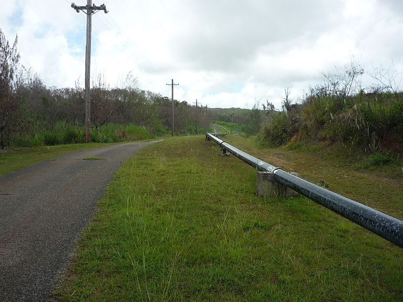
In about 1/4 mile, the power line turns to the left along the side of the pipeline road.  If instead, you followed the pipeline road to the right, you would come to the locked gate.

In about 1/4 mile, the power line turns to the left going along the side of the pipeline road. If instead, you followed the pipeline road to the right, you would come to the locked gate.

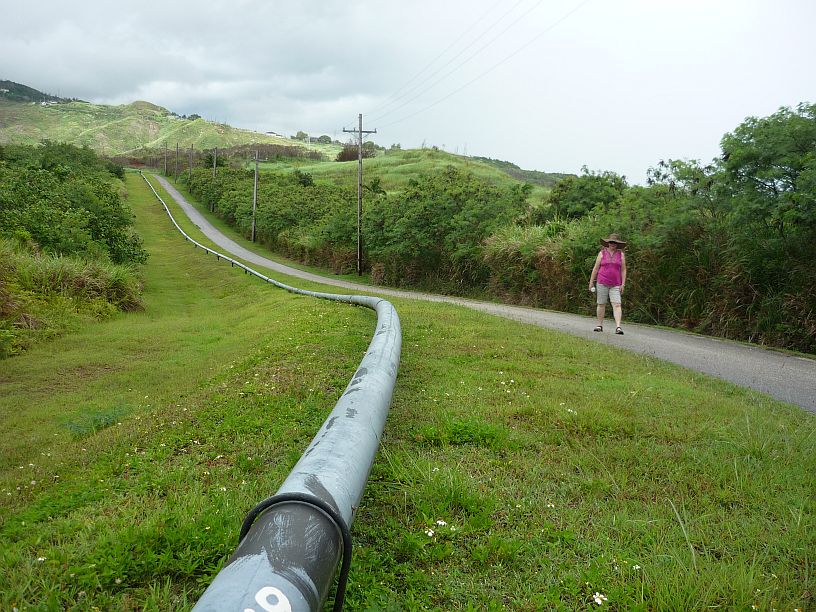
We followed the pipeline in a ENE direction for about one mile.

We followed the pipeline east-north-east for about one mile.

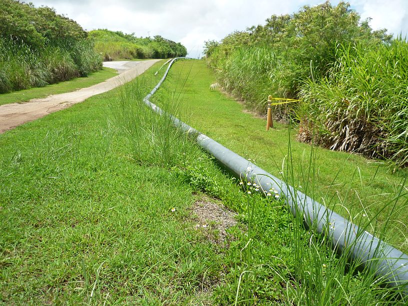
The turnoff to the crash memorial and site is unmarked, but obvious.  The crash resulted in this pipeline being damaged and it looks like this section might have been repaired.

The turnoff to the crash memorial and site is unmarked, but obvious. The crash resulted in this pipeline being damaged and it looks like this section might have been repaired at this location.

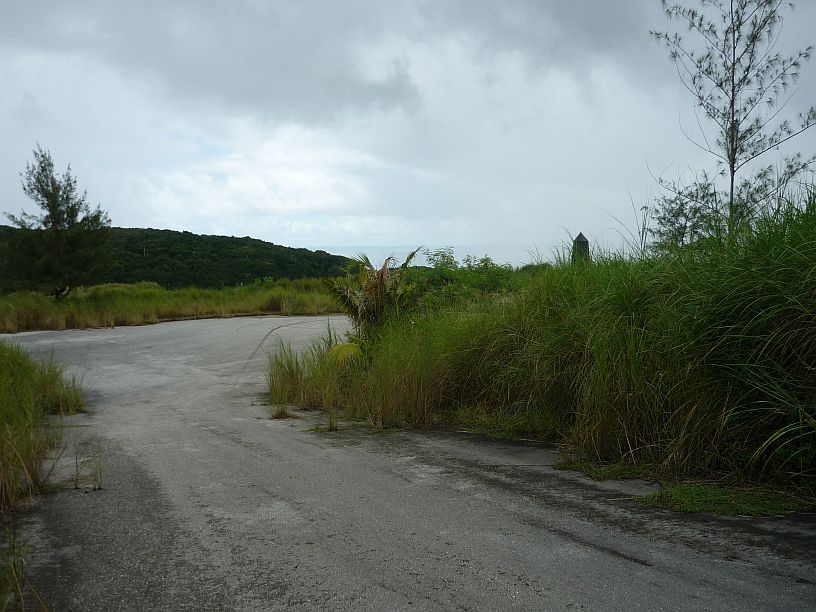
The side road to the memorial is starting be become overgrown, but the black obelisk can be seen to the right,

The 100 yard long road to the memorial is starting become overgrown, but the black obelisk can be seen to the right,

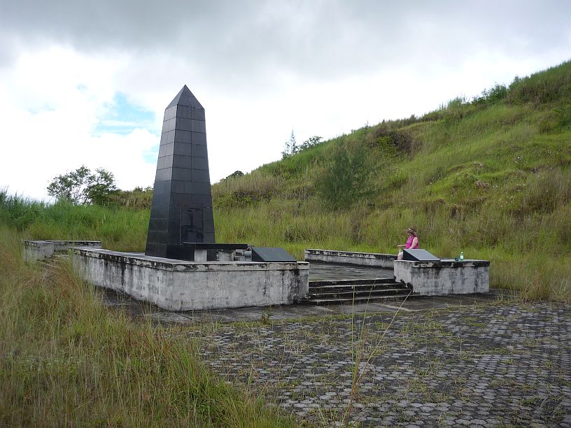
The Korean Airlines 801 memorial -- hopefully, it will be tidied up before August 6 for the anniversary visitors.

The Korean Airlines 801 memorial — hopefully, it will be tidied up before August 6 for the anniversary visitors.

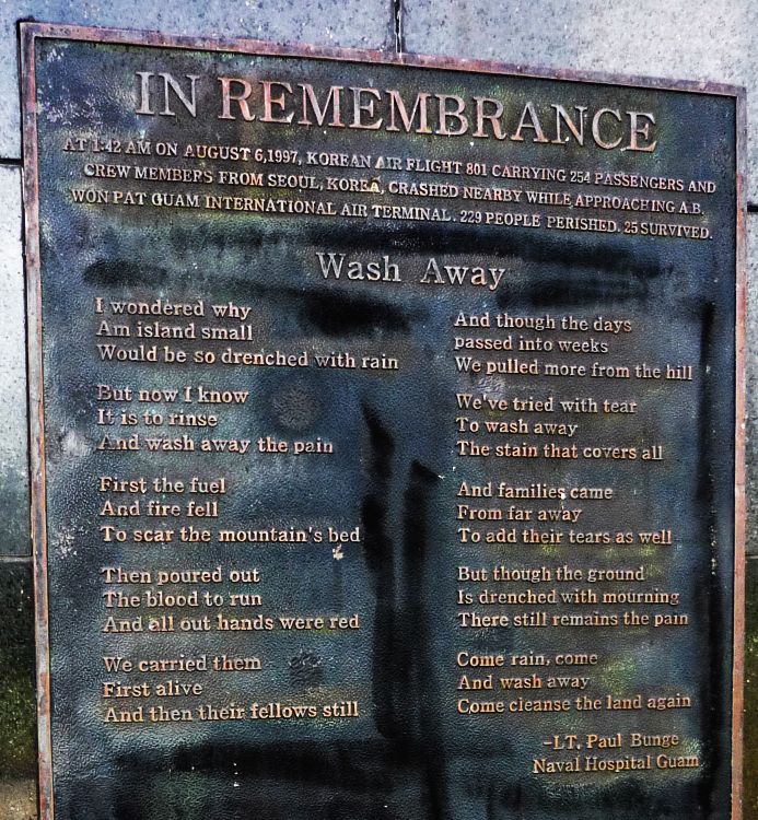
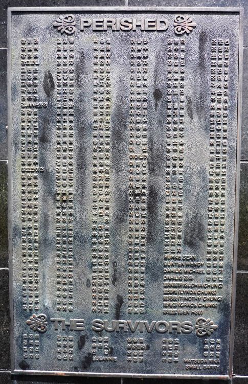
140628 -- MemorialPlaque140628 -- MemorialPoem

How many of these names can you read?

How many of these names can you identify?

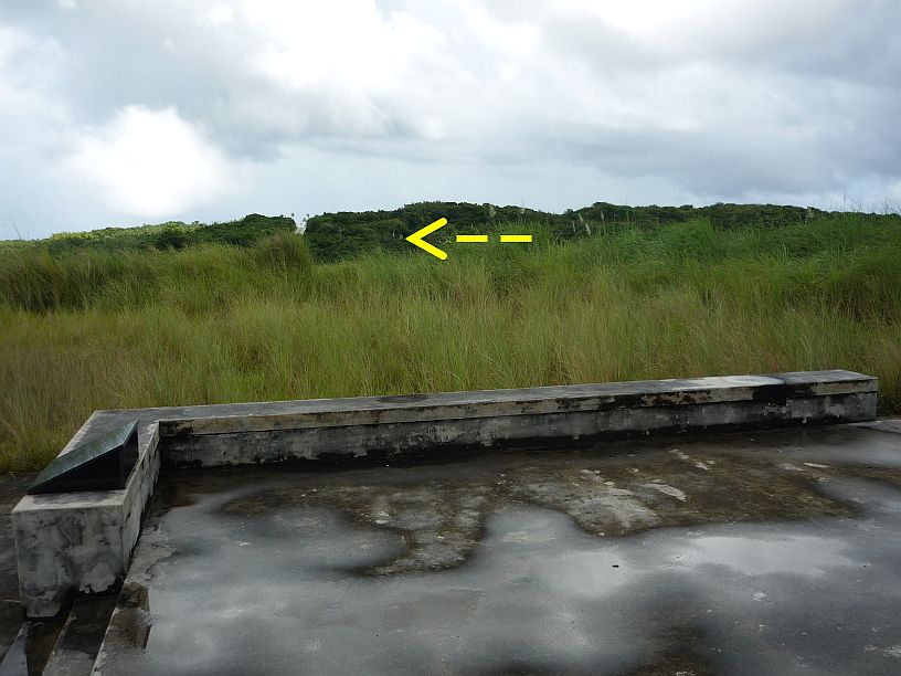
Before leaving the memorial, we noticed that we could see the entrance to the Japanese command center, from which we had seen the top of the memorial last week.

Before leaving the memorial, we noticed that we could see the entrance to the Japanese command center, from which we had seen the top of the memorial last week.

This focuses in on the Japanese command center in the previous photo.

This focuses in on the Japanese command center in the previous photo.

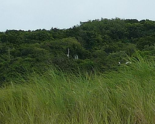
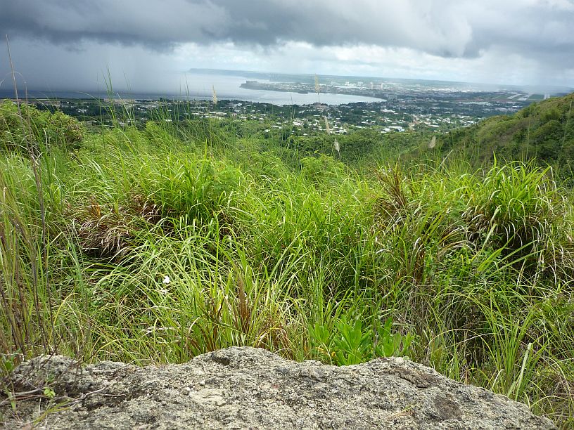
From the crash site, we walked 100 yards to the top of the hill, about 100 feet higher in elevation.  From there we could see the airport (far right) and Agana  Bay (left with rain showers) and the cities of Hagatna (nearest -- formerly Agana) and Tamuning (to the left of the airport and on the peninsula).

From the crash site, we walked about 100 yards to the top of the hill and about 100 feet higher in elevation. From there, we could see the airport (far right) and Agana Bay (left with rain showers) and the cities of Hagatna (nearest — formerly Agana) and Tamuning (to the left of the airport and onto the peninsula).

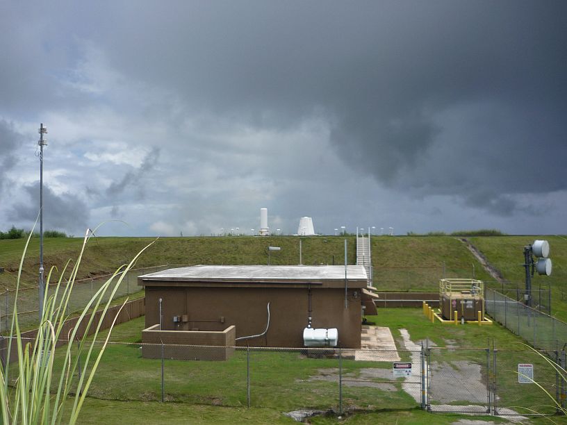
Also, on this same hill, is the VOR (VHF Omni-directional radio Range) site for the airport.  This and the pipeline are probably the reasons that this is a restricted access area.

Also, on this same hill, is the VOR (VHF Omni-directional radio Range) site for the airport. This and the pipeline are probably the reasons that this is a restricted access area.

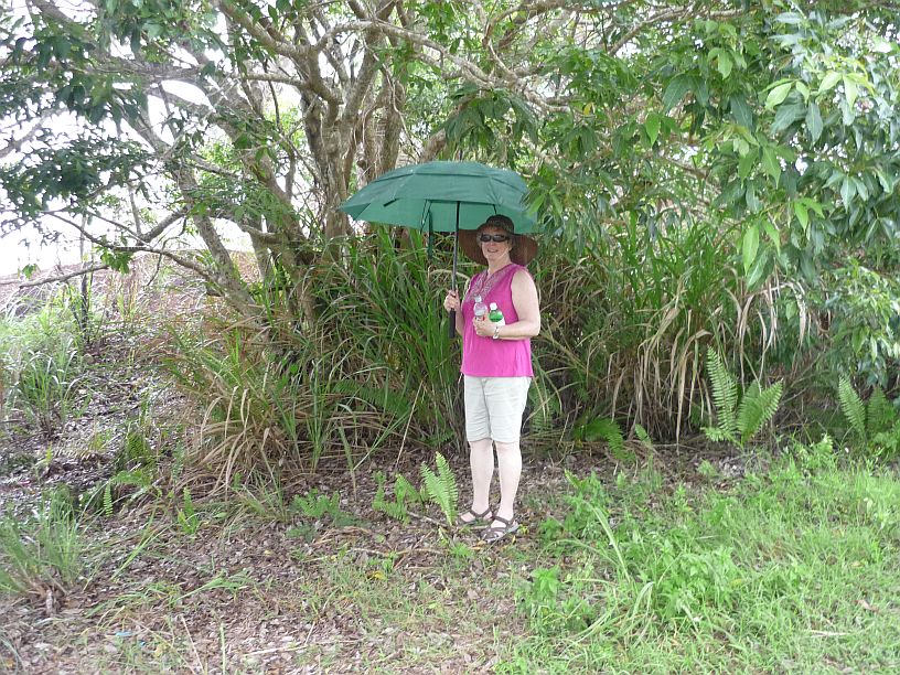
On the way back to our vehicle, the rain caught up with us!  Fortunately, there was no lightning, otherwise we would not have sheltered under a tree or hold an umbrella!  The light rain quickly changed to drizzle and we completed our first hike of the day.

On the way back to our vehicle, the rain caught up with us! Fortunately, there was no lightning, otherwise we would not have sheltered under a tree or hold an umbrella! The light rain quickly changed to drizzle and we completed our first hike of the day. Virginia is holding our water supply for the hike.  We found that plastic soda bottles are much stronger than the thin plastic used in the water bottles sold at the store.


2014/06/27 — Friday — Priorities Change

Joel and Jim are scheduled to work night shift over the weekend.  Since Jim is the welding expert, that kind work on the antenna switches has been put on hold until he returns on Tuesday.

Since my usual transportation to work is with Joel, I waited by the road and hitched a ride with Paul.

This morning, I had planned to fabricate parts for the antenna switch lines so they would be ready to ‘weld’ when Jim gets back on day shift. But, when Mike discovered that the standby power plant would start but would not generate voltage, our priorities were altered for the day. It was eventually determined that the electronic voltage regulator had failed and no spare could be found anywhere in stock.The faulty regulator is potted in hard silicone rubber, making it virtually impossible to repair.

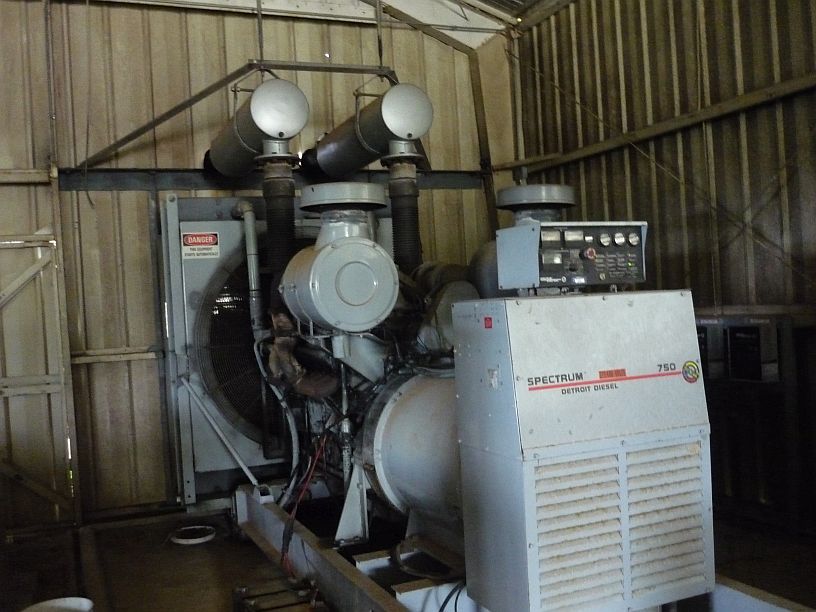
This is the 750,000-watt standby power plant that is used to power the transmitters in the event of a power failure.  The regulator is located in the box on the end just behind the word, "Spectrum".

This is the 750,000-watt standby power plant that is used to power the transmitters in the event of a power failure. The regulator is located on the side of the box on the end just behind the letter ‘S’ in the word, “Spectrum”.

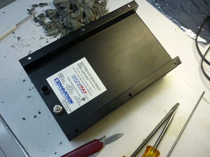
The failed regulator on the workbench in the lab.

The failed regulator on the workbench in the lab.

We did extensive searching on the internet and found that this regulator is now obsolete and

This digital regulator is much smaller than the original regulator.

This digital regulator is much smaller than the original regulator.

there are none available on Ebay nor on the surplus market.  Fortunately, a digital voltage regulator has been found that can electrically replace the old one. Of course, it is at a higher cost and will need to be programmed, in addition to the mechanical modifications needed for its installation.

In the meantime, we are without standby power and praying that it will not be needed as the rainy season seems to have begun.