Reviewing the transmitter log this morning, I noticed that there had been two cutbacks early in the morning. I reduced the Audio Input by 0.1dBu to 8.0dBu. This is the level to which it was set on 20 Oct 2010 and that night and following morning there were no cutbacks.

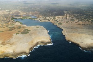
Aerial view of the Lagoon -- note the two buildings that comprise the settlement of Boven Bolivia. This photo must have been taken when they were in much better repair!
Virginia’s blog covered what we did. Just wanted to add that the first place we headed was to the Lagoon (Lagoen) located by Boven Bolivia on the map (ENE of Kralendijk on the east coast). The map leads one to believe that there is a village there, but we only saw what looked like an abandoned shop or hotel at the west end of the lagoon. I think the view would have been better from the south side of the lagoon and there is supposed to be a ‘blowhole’ near there. But the road to that side might be a challenge to find! There are no road signs and definitely no paved roads to get there.
From the lagoon we followed a rocky, dirt road (if you can call it that) to the extreme east point of Bonaire. Virginia explained that experience quite well in her blog entry.
NOTE — To see a bigger (and in some cases, expanded) version of any of the images in this blog, just click on the one you want to see.
Lagoon photo: http://commondatastorage.googleapis.com/static.panoramio.com/photos/original/1197485.jpg
