2014/07/14 — Monday — Servo Amp Repair

Not much happened on the antenna switch installation, because Jim worked shifts over the weekend and today was his day off.

I did troubleshooting of two servo amplifiers for the Thompson transmitters.  There are two spares and neither of them work.  Each amplifier has two different boards.  We discovered that only one board was bad on each amplifier.  Fortunately, the bad board on each amplifier was not the same type on both.  It was possible to make one good amplifier out of the two.140714 -- ServoAmpsOur evening was spent working on our August 2014 McGuiReport, which is due for proofreading on 15 July.


2014/07/13 — Sunday — Ritidian

There was a great septet of lady Chamorro singers at Harvest Baptist Church.  Pastor Herron continued his series of messages from Genesis on the life of Joseph.  This series will come to an end on the last Sunday we are here.  How’s that for timing?!

140713 -- SeptetAfter church we headed north to Ritidian Point. This is the place we arrived at last week too late to enter.  We wanted to get there as quickly as possible.  Here is a photo tour of our afternoon:

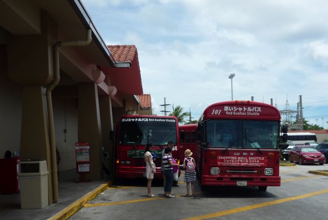
First a quick stop at Home Depot to get a replacement light switch for one of our ceiling fans, then a quick stop at Kmart for some bread and milk.  At Kmart we saw at least four buses bring Japanese tourists from the hotels.

First a quick stop at Home Depot to get a replacement light switch for one of our ceiling fans, then a quick stop at Kmart for some bread and milk. At Kmart we saw at least four buses bring Japanese tourists from the hotels. It was BUSY inside!

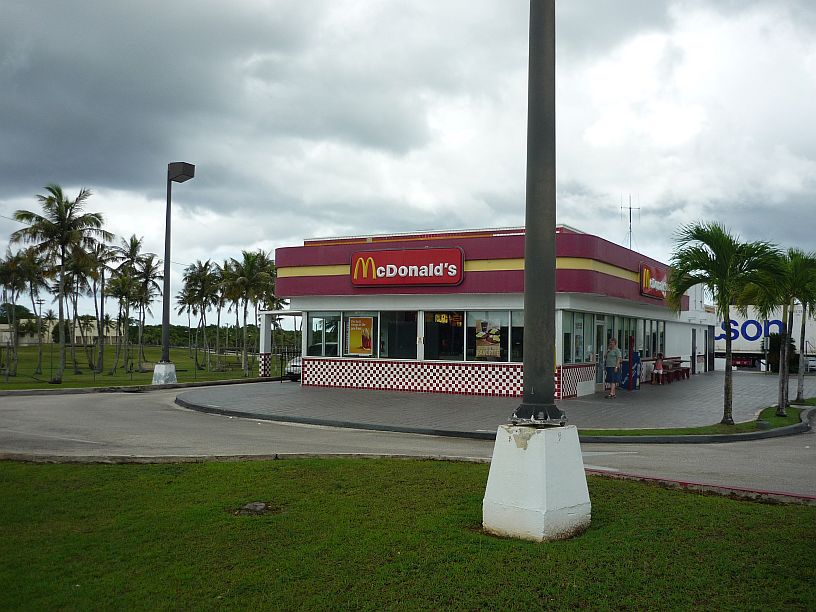
To get a quick lunch, we stopped at this McDonalds, with a retro look, on the way.  Actually it is on Navy property, but open to the public.  The fence of Navy property goes around the perimeter on three side.  There were two large refrigerated semi trailers parked behind the store to provide extra cold room capacity.

To get a quick lunch, we stopped at this McDonalds, with a retro look, on the way. Actually it is on Navy property, but open to the public. The fence of the Navy property goes around three side. There were two large refrigerated semi trailers parked behind the store to provide extra cold room capacity, so it must be quite busy at times.

The road to Ritidian became quite full of potholes after the last main gate into Anderson Air Force Base.

The road to Ritidian became quite full of potholes after the last main gate into Anderson Air Force Base.

Just before descending to the beach, we came to this overlook.

Just before descending to the beach, we came to this overlook.

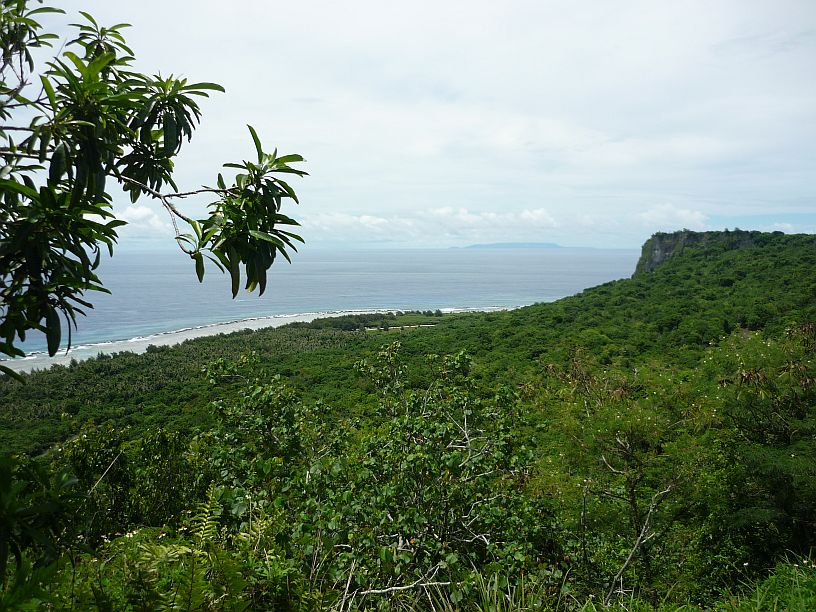
Ritidian Point and Beach from the overlook.  On the horizon, it is possible to see another island.

Ritidian Point and Beach from the overlook. On the horizon, it is possible to see another island.

The island of Rota is about 40 miles away.  Although smaller than Guam, Rota's mountains are higher.  As of July 2013, there were just 131 registered automobiles on the island of Rota -- http://en.wikipedia.org/wiki/Rota_(island) -- compared to tens of thousands on Guam!

The island of Rota is about 40 miles away. Although smaller than Guam, Rota’s mountains are higher. As of July 2013, there were just 131 registered automobiles on the island of Rota — http://en.wikipedia.org/wiki/Rota_(island) — compared to tens of thousands on Guam!

After descending down a winding road we arrived at the welcome center (closed on Sunday).

After descending down a winding road we arrived at the nature center (closed on Sunday) at Ritidian Beach.

Looks like we will not be swimming today, not only because we did not bring our swimsuits!

Looks like we will not be swimming today, not only because we did not bring our swimsuits!

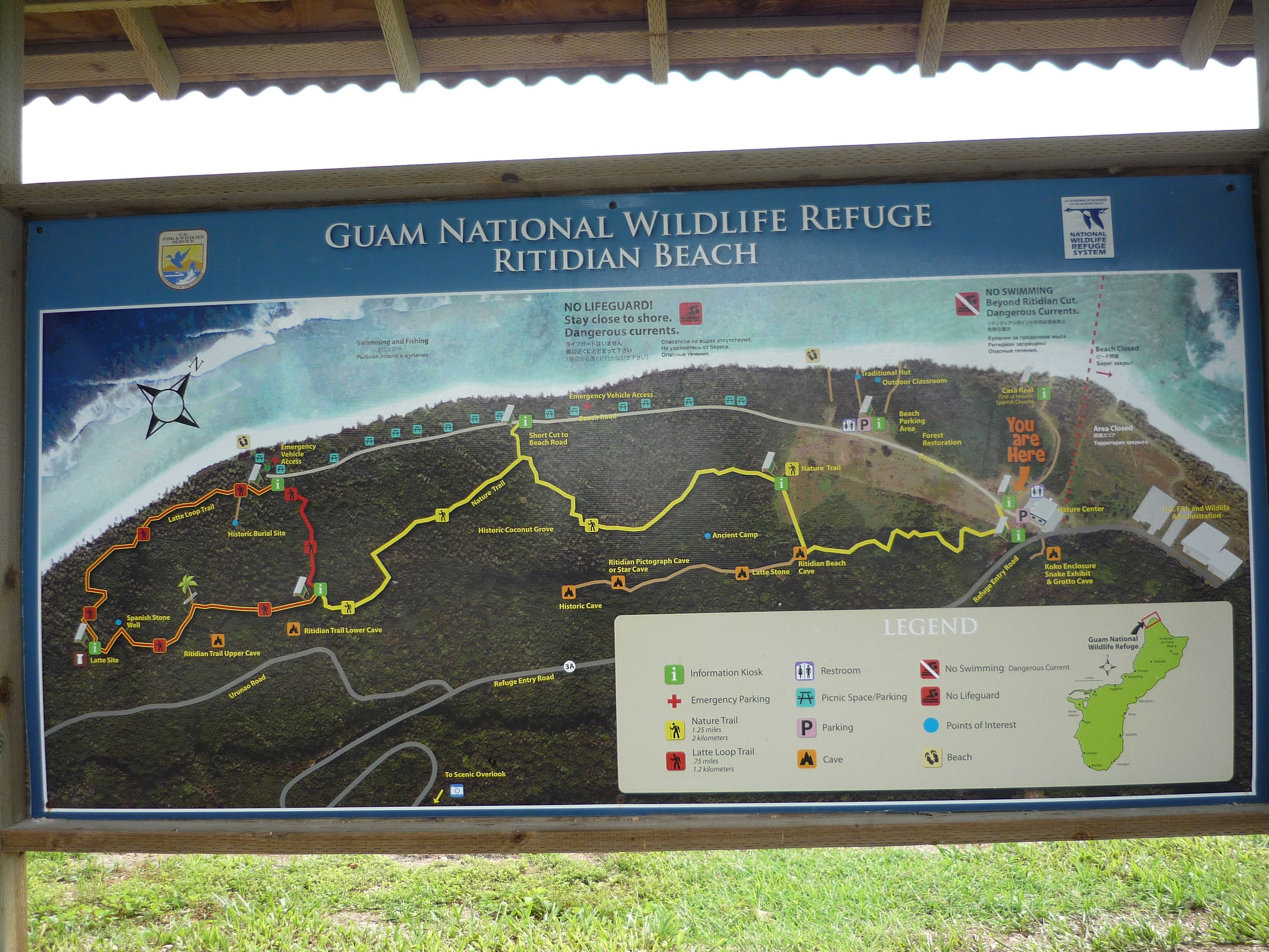
We found a nice map that was used to plan our excursions for the afternoon.

We found a nice map that was used to plan our excursions for the afternoon.

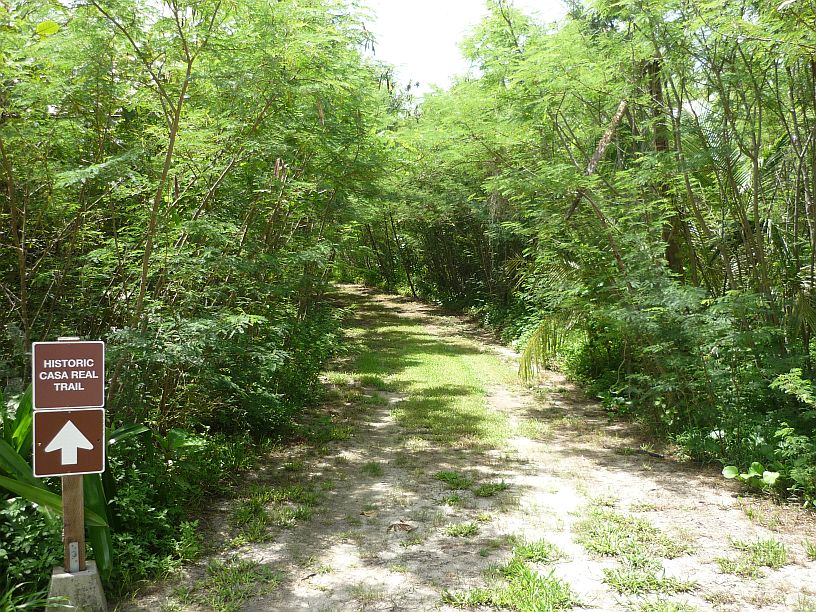
Our first trail originated at the nature center.  We're off to find Casa Real the site of an old church.

Our first trail originated at the nature center and headed toward the beach. We’re off to find “Casa Real (Site of Old Spanish Church).”

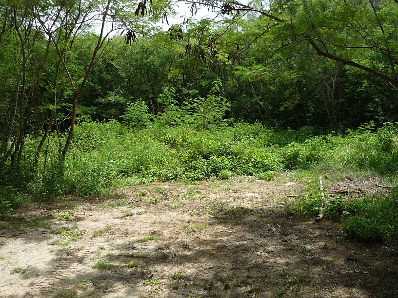
We looked all over for Casa Real, but found no signs or anything else, except maybe this 'clearing'.  Doing research at home we found that although there are photographs of ruins taken in 1952, that the area was bulldozed in the 1960 for a Navy Sound Surveillance System (SOSUS).

We looked all over for Casa Real, but found no signs or anything else, except maybe this ‘clearing’. Doing research later, we found that although there are photographs of ruins taken in 1952, that the area was bulldozed in the 1960s for a Navy Sound Surveillance System (SOSUS), which was decommissioned  in 1992 after the Cold War. This information should be on the provided maps, or at least on a sign.  We wonder how many other people have searched and found nothing!

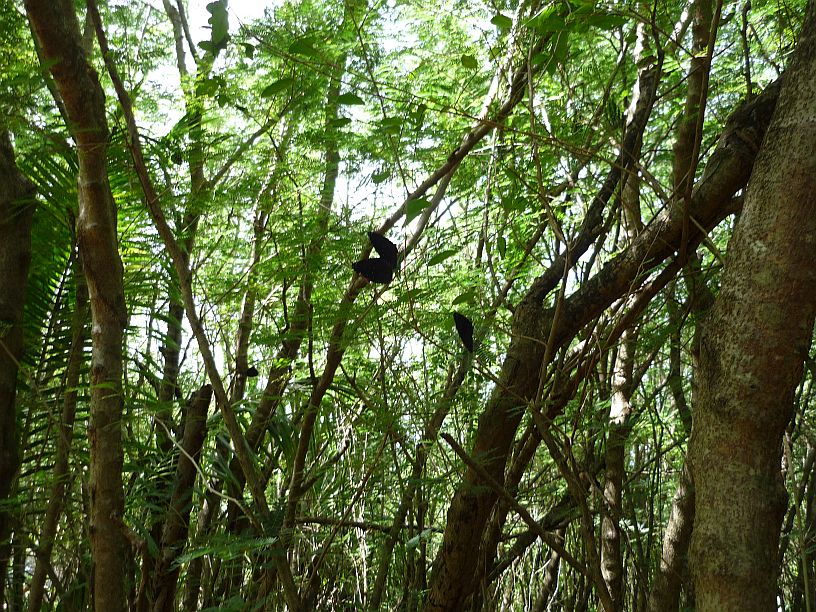
Walking through the ‘jungle’ towards the beach, we did find hundreds, maybe thousands, of butterflies — they were everywhere! It was hard to get a photo of them, but a few can be seen on the branches.

Each butterfly would land, folds its wings and then open them once, or twice, before keeping them folded.  It was a challenge to try to catch on with its wings open, especially with the time delayed shutter of our small camera.

Each butterfly would land, folds its wings and then open them once, or twice, before keeping them folded. It was a challenge to try to catch one with its wings open and get it in focus, especially with the time delayed shutter of our small camera.  Here’s the best we could do.  These are Blue Banded King Crow Butterflies.

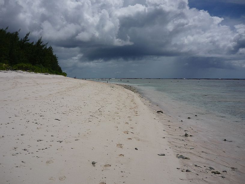
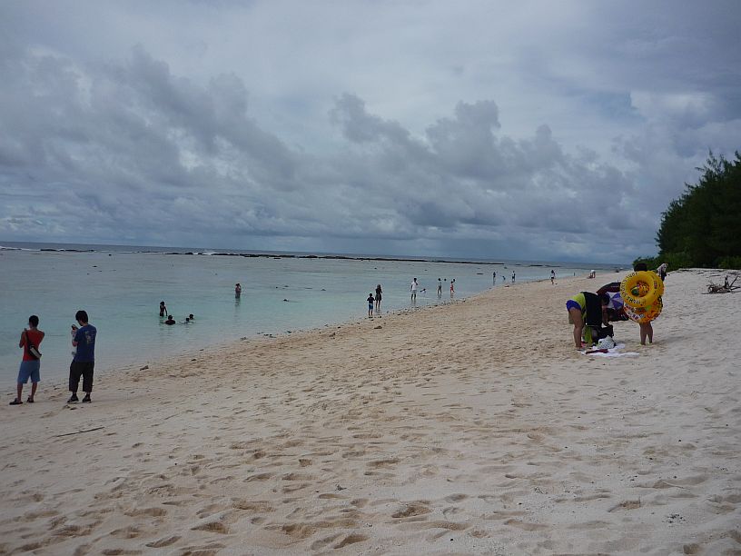
After passing through the 'butterfly forest', we reached beautiful Ritidian Beach.  This is looking to the left (west).

After passing through the ‘butterfly forest’, we reached the beautiful white sands of Ritidian Beach. This is looking to the left (west).

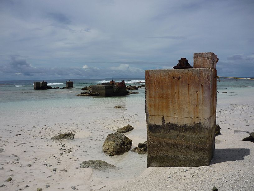
The view to the left (east) intrigued Larry even more. There were lots of huge tower bases and anchors. There are two tower based and at least two anchors in this photo.  After much searching, we found a clue for what they were --     tower based and at least two anchors in this photo.  http://vw1assoc.tripod.com/crossroads_nov_62_pg13.html

The view to the right (east) intrigued Larry even more. There were lots of huge tower bases and anchors. There are two tower bases and three anchors in this photo.  After much searching on the internet, we found a clue that it might be the remains of the Pacific Scatter Communications System — http://vw1assoc.tripod.com/crossroads_nov_62_pg13.html

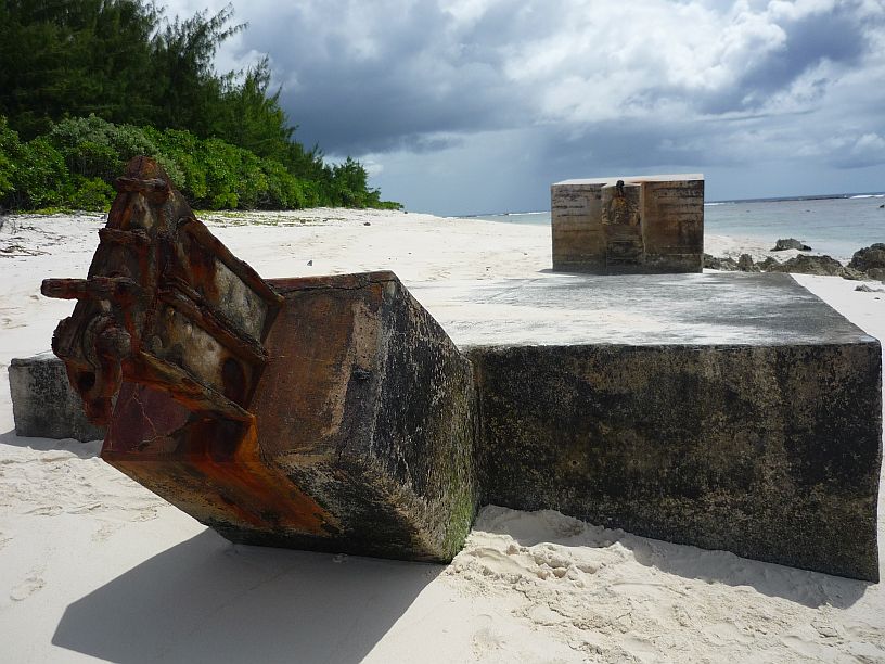
These two anchors were behind the photographer in the previous photo.

These two anchors were behind the photographer in the previous photo.

In the distance, more tower bases and anchors can be seen.  They are in a restricted area behind the rope attached to this tower base.  This must have been a massive installation.

In the distance, more tower bases and anchors can be seen. They are in a restricted area behind the rope attached to this tower base. This must have been a massive communications installation!

Looking up at Ritidian Point from the tower base.

Looking up at Ritidian Point from the tower base.

We picked up a pretty shell off the sand only to find it was inhabited -- by a hermit crab!

We picked up a pretty shell off the white sand beach only to find it was inhabited — by a hermit crab!

We returned to the nature center and followed a trail away from the beach hoping to find a cave with paintings.  Soon we entered what is called a 'historic coconut forest'.

We returned to the nature center and followed a trail away from the beach hoping to find a cave with paintings. Soon we entered what is called a ‘historic coconut grove’.

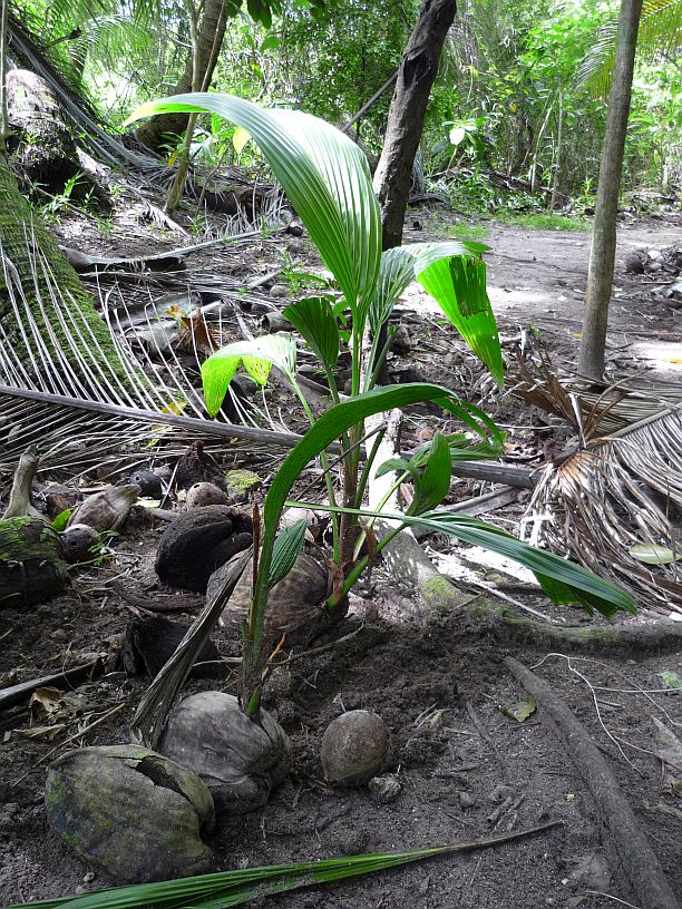
There were lots coconuts on the ground in the grove and many of them were sprouting,

There were lots of coconuts on the ground in the grove and many of them were sprouting,

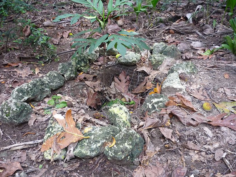
We also found a few of these 'mystery' fruit laying on the ground.  They were about 6 inches in length.

We also found a few bread fruit laying on the ground. This one is about 6 inches in length.

When we got to Ritidian Beach Cave the trail was closed.  the entrance is just tall enough to walk into without bending down.  Apparently the caves and trail are closed for archeological reasons, so we did not go inside and returned to the nature center.

When we got to Ritidian Beach Cave the trail was closed. The cave entrance is just tall enough to walk into without bending down. Apparently the caves and trail are closed for archeological reasons — this should have been noted on the trails map! We did not go inside, but returned to the nature center.

We drove down the beach road to the next trail to the beach.

We drove down the beach road to the next trail to the beach.

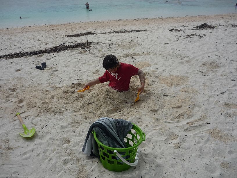
One young boy was enjoying himself on the beach!

One young boy was enjoying himself on the beach!

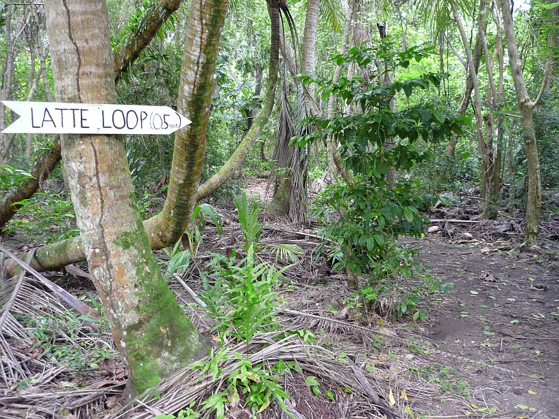
We drove to the end of the beach road and explored the Latte Loop trail.

We drove to the end of the beach road and explored the Latte Loop trail. We did not find the Latte Stone that was supposed to be on the loop,  Maybe because the trail is rather primitive and not well marked.

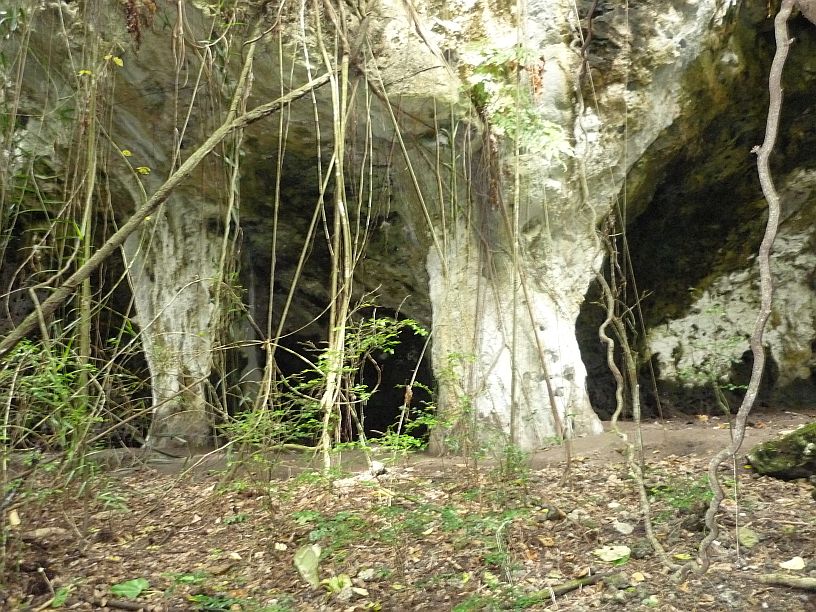
Ritidian Trail Lower Cave

Ritidian Trail Lower Cave

Ritidian Trail Upper Cave

Ritidian Trail Upper Cave

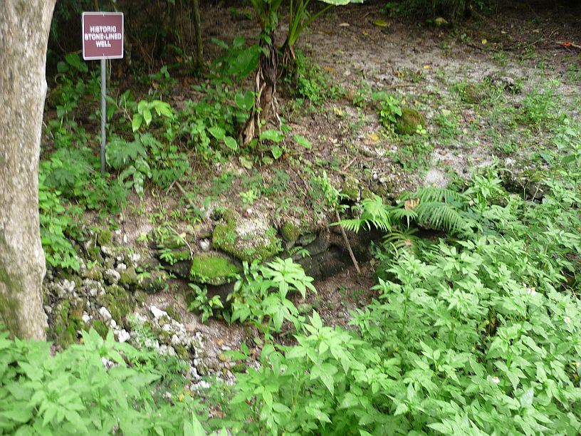
Historic Stone-Lined Well

Historic Stone-Lined Well (couldn’t find any detail on the history of this well).

We may not have found the Latte Stone, but did see several research traps for brown tree snakes.  this trap contained a live bird (looked like a small chicken).  Other traps contained mice.  The 'prey' was inside a small cage inside the trap.

We may not have found the Latte Stone, but did see several research traps for brown tree snakes. This trap contained a small chicken.  Other traps contained mice. The ‘prey’ was inside a small cage, with its own food and water, inside the trap.

It's not very obvious in this photo, but the trail had been 'plowed' up by wild pigs in several places.

It’s not very obvious in this photo, but the trail had been ‘plowed’ up by wild pigs in several places.

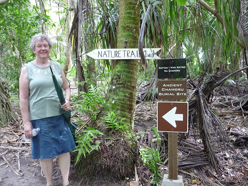
At the end of Latte Loop was another trail to an ancient burial site.

At the end of Latte Loop was another trail to an ancient burial site.

After following several faint trails, we think we found the burial site with only one that was marked with stones.

After following several faint trails, we think we found the burial site with only one grave that was marked with stones.

By this time, we needed to head for home.  Mike had requested that Larry go to the transmitter site with him at 5pm to help repair one of the Thompson transmitter that was having servo problems.  As it turned out, a connector was bad on another servo.  The spare servo motor was installed, and Larry repaired the connector on the servo motor that had been removed.  Another site that uses these Thompson transmitters has replaced all of these connectors with better ones.  That will probably be a good idea here, too — for all 26 servos or 52 connectors!

2014/07/12 — Saturday — South To Merizo

We woke up to find that it was raining fairly hard, but the wind was very light compared to the 60 mph winds that had been forecast.  We learned that the storm warning had been lifted.  Tropical storm Rammasun had swerved to the north, circumvented Guam, and continued on its anticipated course toward the Philippines. We know many were praying — could it be??!!

There was lots of standing water and it was still raining when we looked outside this morning.

There was lots of standing water and it was still raining when we looked outside this morning.  If it keeps raining like this in days ahead, there will be a jungle in our ‘front yard’.

About noon, the rain let up and we decided to head south again and took these photos:

As we started south, we noticed that there was a very low tide.  It appears that it would be possible to walk to these two islands in Agat Bay, which are normally surrounded by water, without getting wet feet.

As we started south, we noticed that there was a very low tide. It appears that it would be possible to walk to these two islands in Agat Bay, which are normally surrounded by water, without getting wet feet.

We made a quick stop at Nimitz Beach Park:
This photo of a picnic table was taken on 28 June 2014.
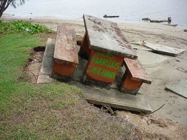
This photo of a picnic table was taken on 28 June 2014.

This photo of the same table was taken on 12 July 2014.  Wonder if tropical storm Neoguri did this or did too many picnickers sit on the wrong side?!

This photo of the same table was taken on 12 July 2014. Wonder if tropical storm Neoguri did this or did too many picnickers sit on the wrong side?!
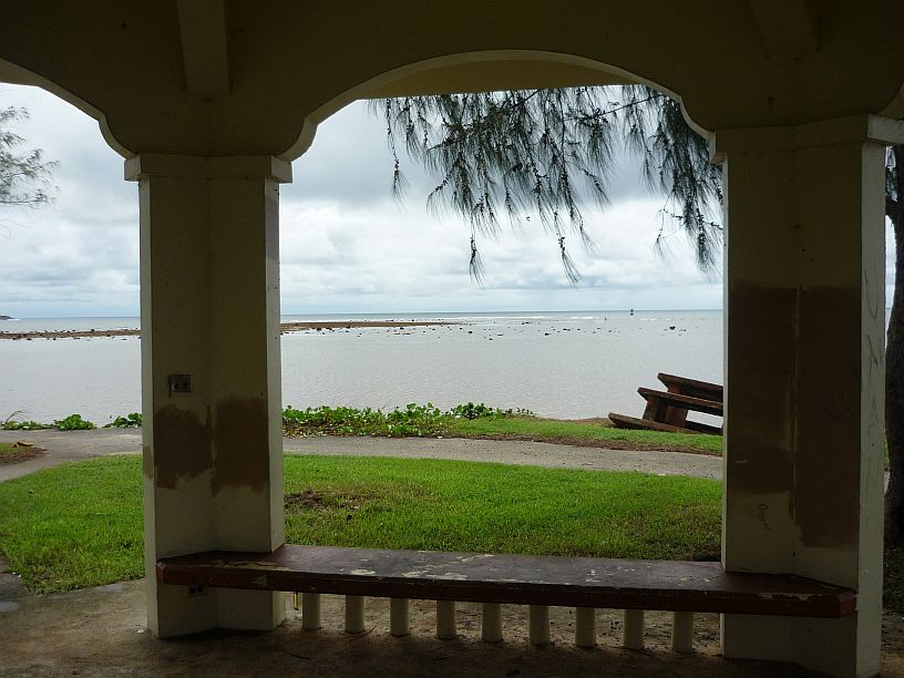
Nimitz Beach at low tide as seen from a pavilion at the park.  The leaning picnic table is at the right.

Nimitz Beach at low tide as seen from a pavilion at the park. The leaning picnic table is at the right.

Our next quick stop was at the Stella Bay Overlook to see if the waterfall was flowing:

The rains from tropical storm Rammasun was enough to start the waterfall at the northern peaks of Mt. Lamlam.

The rains from tropical storm Rammasun was enough to temporarily start the flow of the waterfall on Mt. Lamlam.

Next a quick stop at Cetti Bay Overlook:
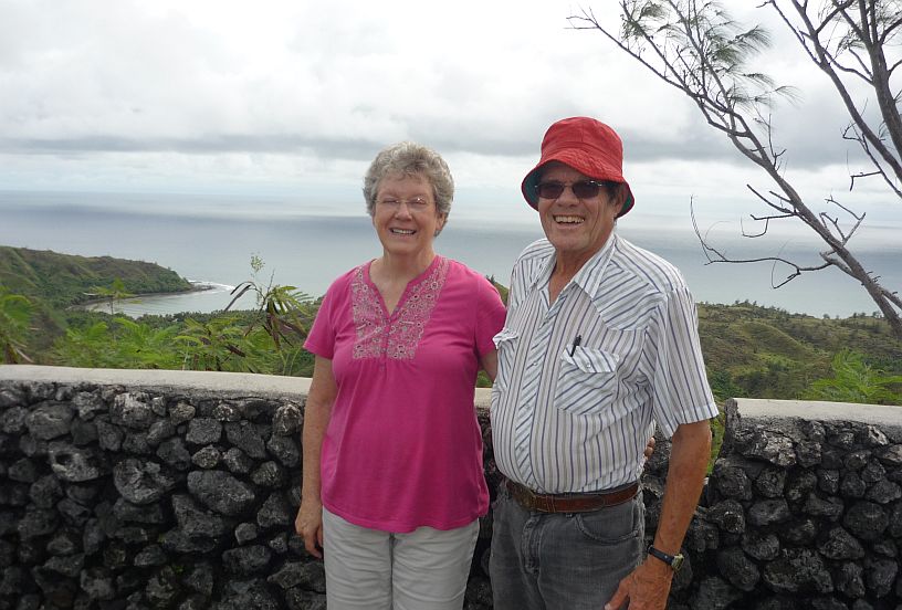
At Cetti Bay overlook, a newly-wed Japanese couple we taking each others' photo.  We offered to use their phone so they would have a photo of both of them together.  Afterwards, they insisted on using our camera to take our photo.

At Cetti Bay overlook, a newly-wed Japanese couple were taking each others’ photo. We offered to use their phone so they would have a photo of both of them together. Afterwards, they insisted on using our camera to take our photo.

It is possible to see the TWR antennas from Cetti Bay.  Cocos Island Resort is also easily seen.

It is possible to see the TWR antennas from Cetti Bay overlook. Cocos Island Resort is also easily seen.
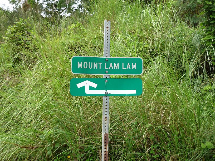
Across the road from the Cetti Bay parking lot, is this small, easy-to-miss, sign marking the trail to Mount Lam Lam.

Across the road from the Cetti Bay parking lot, is this small, easy-to-miss, sign marking the trail to Mount Lam Lam.

This is the start of the one mile trail up Mt. Lam Lam.  Partway up there is a branch to the right going to Mt Jumullong Manglo.

This is the start of the one mile trail up Mt. Lam Lam. Partway up there is a branch to the right going to Mt Jumullong Manglo.  We did not try to hike this trail today, because it is extremely slippery from the rain of tropical storm Rammasun.

Mt Jumullong Manglo, to the south of Mt Lam Lam, has about a dozen crosses on the top. It is the second highest peak on Guam at 1,283 feet.  Hundreds of Guam Catholics make an annual pilgrimage on Good Friday to the top.

Mt Jumullong Manglo, to the south of Mt Lam Lam, is the second highest peak on Guam at 1,283 feet. Hundreds of Guam Catholics make an annual Good Friday pilgrimage to the top where about a dozen crosses are located.

Our next stop was at Merizo — http://www.guampedia.com/merizo-malesso  — where we were rained out on our last trip south:
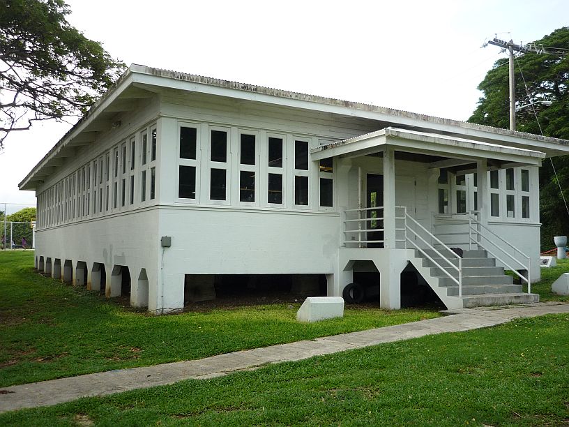
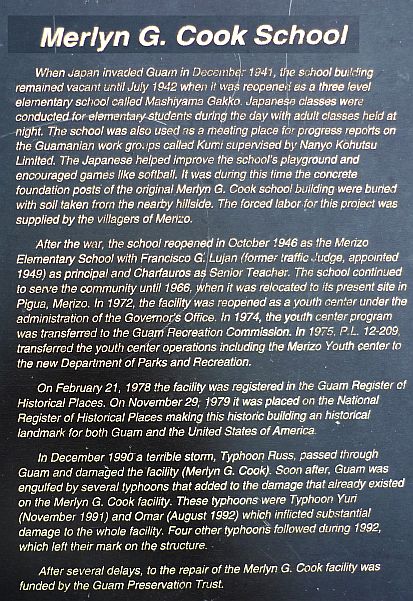
The Meryl G Cook School in Merizo was built before World War II.

This Merlyn G. Cook school in Merizo was originally built in early 1941 by the US Navy for radio communications just before the Japanese invasion.
140712 -- CookSchoolSign

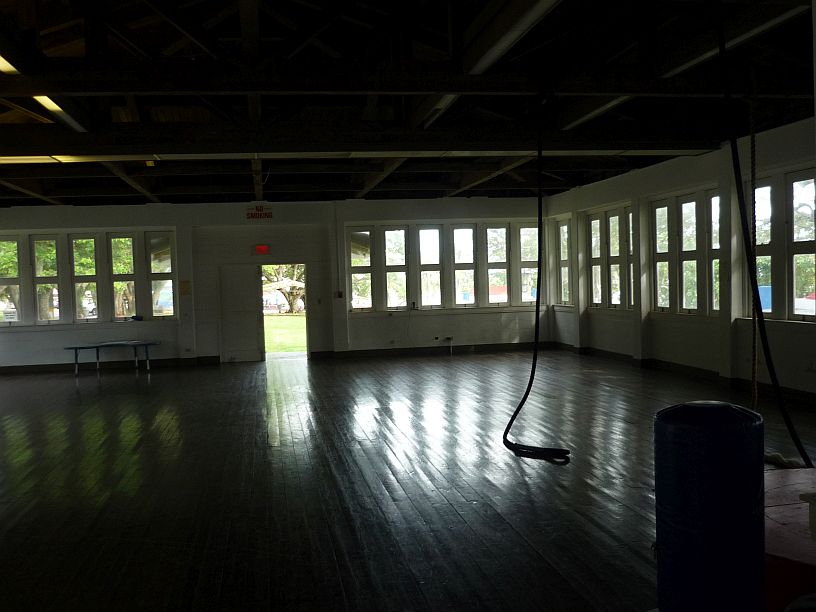
The school's doors were open, so we got a chance to see inside.

The school’s doors were open, so we got a chance to see inside.

On the wall inside the school were some photos of the school after a cyclone.

On the wall inside the school were some photos of the school after a typhoon.
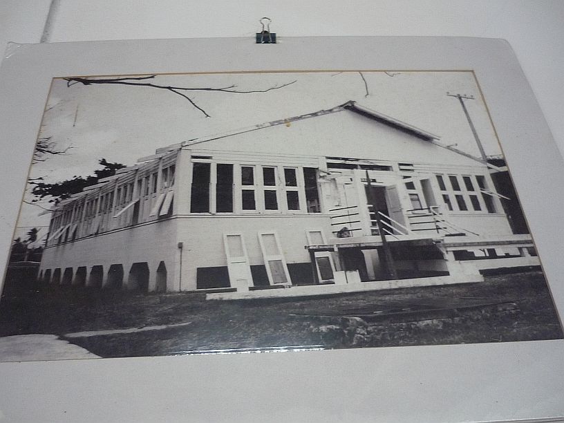
This photo show how the windows tilt in the middle to provide ventilation.
This photo show how the windows pivot in the middle to provide ventilation.

Immediately south of the school is Merizo Pier Park.  It was just off this pier, less than six days ago, that two men drown when their boat capsized due to tropical storm Neoguri.

Immediately south of the school is Merizo Pier Park. It was just off this pier, less than six days ago, that two men drown when their boat capsized due to tropical storm Neoguri.

The bathrooms at Merizo Pier Park had mural painted on them.

The bathrooms at Merizo Pier Park had murals painted on them.

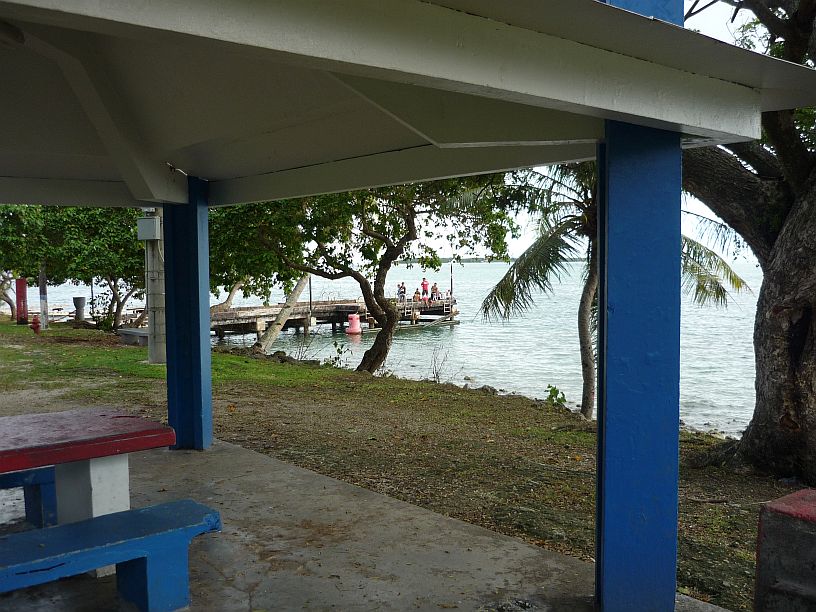
140712 -- MerizoMural2Immediately south of the Merizo Pier, is the dock for the boat to Cocos Island Resort.
Immediately south of the Merizo Pier, is the dock for the boat to Cocos Island Resort.
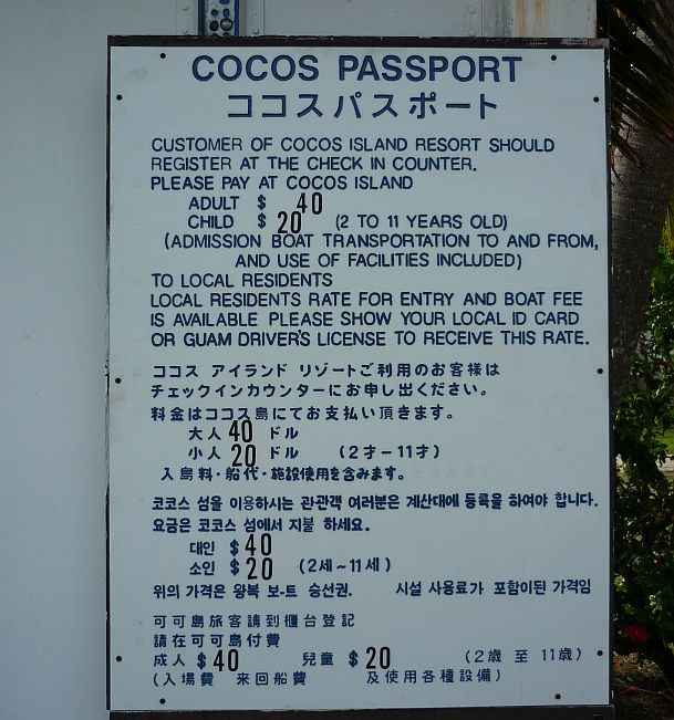
140712 -- CocosSignEach day as Larry rides to work he has noticed this ferry for vehicles next to the Cocos dock, but has never seen it move.

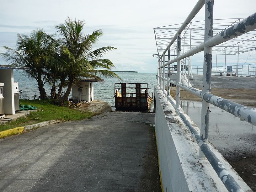
Each day as Larry rides to work he has noticed this ferry for vehicles next to the Cocos dock, but has never seen it move.

Now we know why it never moves!!
Now we know why it never moves!!

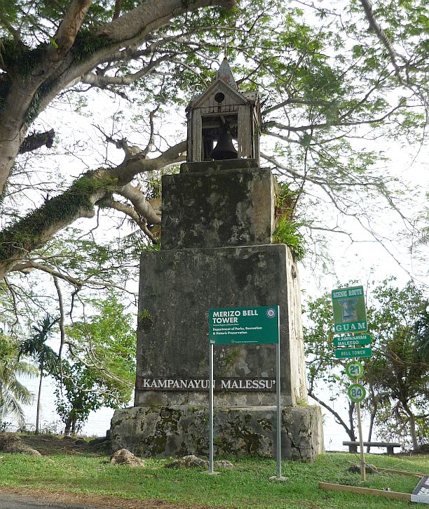
About 0.2 mile southeast of Merizo Pier is this old bell tower, built about 1919 -- http://en.wikipedia.org/wiki/Merizo_Bell_Tower

About 0.2 mile southeast of Merizo Pier is this old bell tower, built about 1914 — http://en.wikipedia.org/wiki/Merizo_Bell_Tower

Virginia by the Merizo Bell Tower

Virginia by the Merizo Bell Tower — looks like it needs some upkeep!

The Our Lady of Camarin statue is in a park next to the Bell Tower.
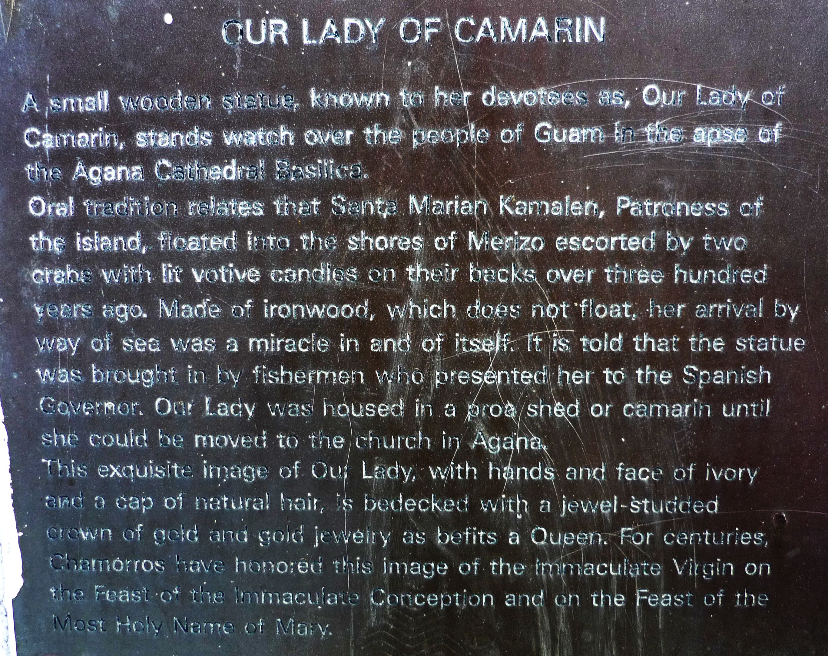
The Our Lady of Camarin statue is in a park next to the Bell Tower.

140712 -- CamarinSign

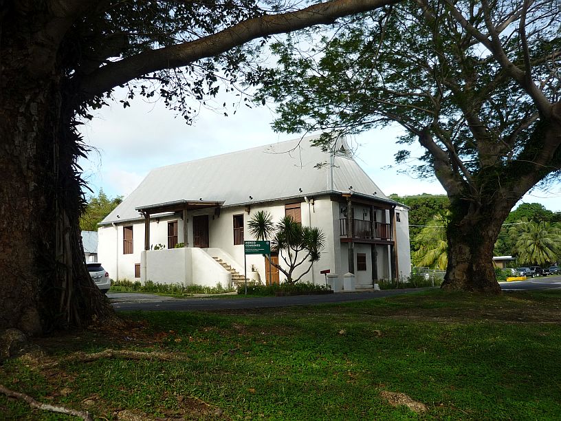
Malesso Kombento, located across the road from the Bell Tower, was built in 1856 and is supposedly the oldest building on Guam.
Malesso Kombento, located across the road from the Bell Tower, was built in 1856 and is supposedly the oldest building on Guam.

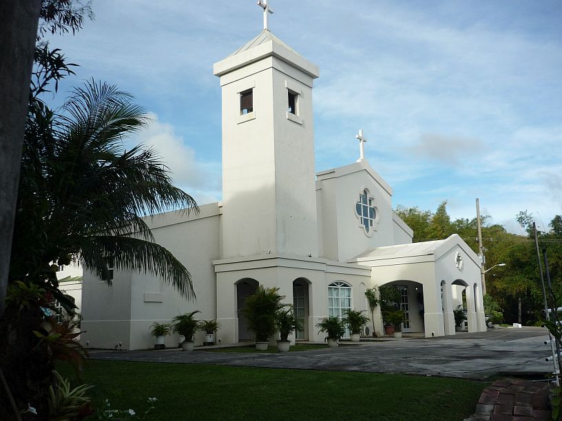
Behind Malesso Kombento, is San Dimas Catholic Church.  The road to The TWR transmitter site runs up the hill along side these two buildings.

Behind Malesso Kombento, is San Dimas Catholic Church. The road to The TWR transmitter site runs up the hill along the other side these two buildings.  There is a trail to an overlook that starts in the corner of the parking lot from which this photo was taken.

Virginia navigating the trail from the church.

Virginia navigating the trail from the church.  The trail has not been maintained, nor used, for a long time.

The Way of the Mellinnium Overlook -- looking down on the church and  Merizo Conbento.

The Way of the Mellinnium Overlook — looking down on the church and Malleso Kombento.

Cocos Island Resort seen from the overlook.

Cocos Island Resort as seen from the overlook.
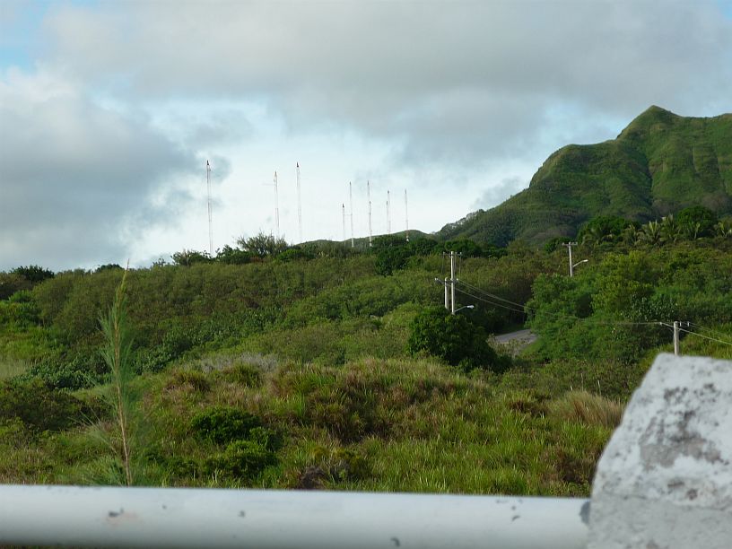
Looking the other way at the overlook, it is possible to see the TWR towers and the road winding up the hill.

Looking the other way from the overlook, it is possible to see the TWR towers and the road winding up the hill.
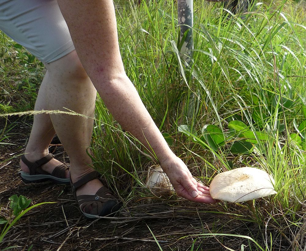
Hiking back down the trail, we found this mushroom.
Hiking back down the trail, we found this mushroom.

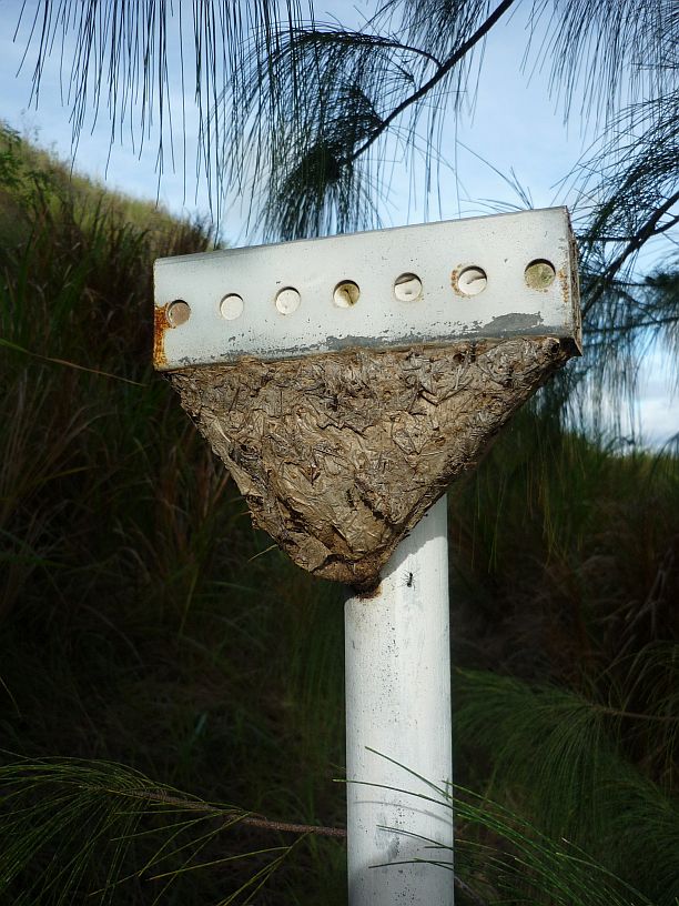
Also on this trail we found this ants nest on a pole.  The crosspiece at the top is about 8" long.

Also on this trail we found this nest on a pole. The crosspiece at the top is about 8″ long.  We have not been able to determine what is is, but there were ants all over it.  Is it some type of ants’ nest?  It was made of some type of plant material.

We headed back north toward ‘home’ in Agat, but decided to stop at the village of Umatac to see if we could be more successful in locating Fort Santo Angel than last time.  This time, we determined to try access from along the shore.  Virginia was not wearing shoes to traverse the rocky shore and waited for me.  Starting from the sign for Fort Santo Angelo — http://www.guampedia.com/fort-santo-angel/ —  I walked along the rocky shore for about 100 yards and saw steps heading up the rock at the entrance to Umatac Bay.

Walking on the shore, it was easy to see the Fort Santo Angel on top of the rock. [Sorry this photo is out of focus and our camera's battery died before I could retake it.  Will try to replace this photo with a good one]

Walking on the shore, it was easy to see the Fort Santo Angel on top of the rock. [Sorry this photo is out of focus and our camera’s battery died before I could retake it. Will try to replace this photo with a good one]
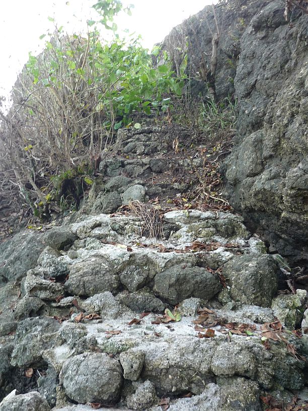
The steps up to Fort Santo Angel were fairly easy to find.  Halfway up the stairs, I met a young couple with a dog on their way down.

The steps up to Fort Santo Angel were fairly easy to find. It is obvious that they are not often used. Halfway up the stairs, I met a young couple with a dog on their way down.

All that is left of the fort are these decaying walls.

All that is left of the fort are these deteriorating walls.

The steps on the wall seem to show that  ati one time this structure was taller.

The steps on the wall seem to show that, at one time, this structure was much taller.

The view from Fort Santo Angel toward the village of Umatac is amazing from about 60 feet above the sea level.

The view from Fort Santo Angel toward the village of Umatac is amazing from about 60 feet above the sea level.  The old courtyard of the fort can be seen in the foreground.
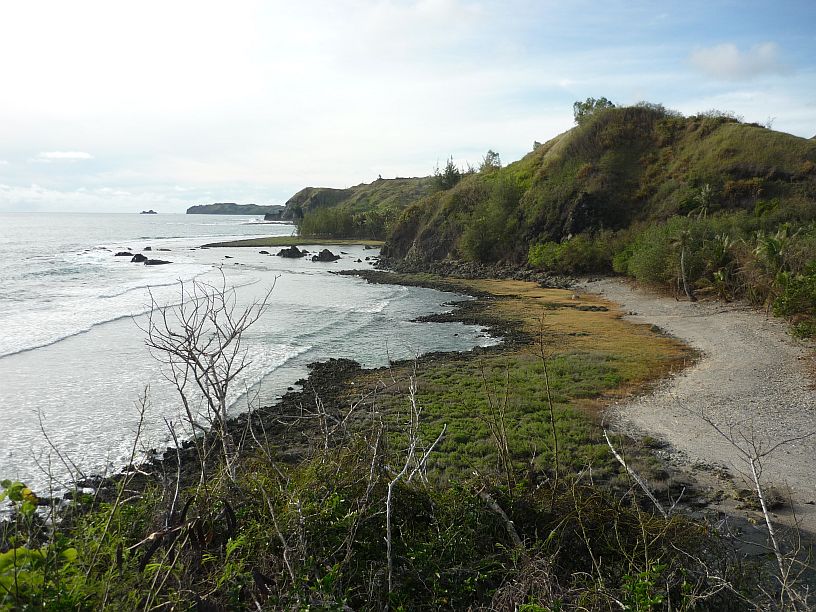
This is the view from Fort Santo Angle towards the north.  This is a great place for the Spanish to defend Umatac Bay

This is the view from Fort Santo Angel towards the north. This is a great place for the Spanish to defend Umatac Bay

We have now visited two, of the four successive, Spanish forts that were used to defend Umatac Bay.  We wonder if we can find Fort Jose, or is it completely gone.   http://www.guampedia.com/fort-san-jose/

2014/07/11 — Friday — Prepare for Tropical Storm Rammasun

I helped Mike inventory the parts for the solar panel array that arrived Monday.  Photos of some of the parts are below:

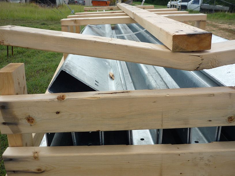
Forty of these steel post are cemented into the ground to support the panels.  Each post supports six solar panels.

Forty of these steel post will be cemented about 6 feet into the ground to support the structure for attaching the solar panels. There will be 4 rows with 10 posts in each row.  Each post will support 6 solar panels.

Each posts will have one of these brackets bolted to its top.  These will allow some adjust of the inclination of the array.

Each post will have one of these brackets bolted to its top. These will allow some adjustment of the inclination of the array.

These aluminum extrusions will be bolted to the brackets and the angle braces will be attached to a hole about 2 feet lower on the posts

These aluminum extrusions will be bolted to the brackets and the angle braces will then be attached to a hole about 2 feet lower on the posts

Because of all the other projects underway here at TWR Guam, a local contractor will be doing the installation of the solar system. Hopefully, he can start on it soon.  We would like to see what it looks like before leaving here on 31 July.
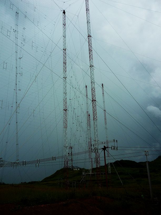
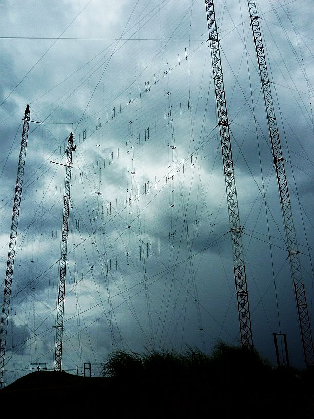
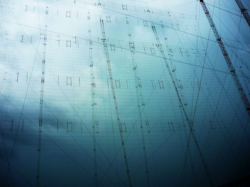
Because of the extra cloudy day, the antenna curtains seemed to stand out more clearly than normal.  Here are a couple fairly clear photos:

Four of the six curtain antennas can be seen in this photo.

Four of the six curtain antennas can be seen in this photo, if you know where to look!

This is one of the highly directional 4X4 curtain antennas and is aimed toward China.

This is one of the highly directional 4X4 curtain antennas that is aimed toward China.

This is actually two antennas with a reflecting screen between.  The one on the far side is a 4X4 curtain aimed toward China and South East Asia.  The one on the near side is a 2X2 curtain aimed toward Australia/New Zealand and Papua New Guinea.

This is actually two antennas with a reflecting screen between. The one on the far side is a 4X4 curtain aimed toward China and South East Asia. The one on the near side is a 2X2 curtain aimed toward Australia/New Zealand and Papua New Guinea.

All day, reports were coming in that tropical storm Rammasun was to hit tonight.  Local stations were warning everyone to prepare for this storm and the possibility of being without power and/or water for several days.  Many offices were closing early to allow their employees to prepare their homes for the storm.

After we prepared the site for the storm, by securing anything that might get blown around in 60 mph winds, Mike allowed us to go home a couple hours earlier than normal.

The first thing we did when I got home was to fill two of our 5-gallon water jugs. The Water Store had already closed for the coming storm, so we headed to another one we had seen about a 1/4 mile in the other direction from our apartment.  Fortunately, it was open.

Virginia filled a large waste basket, a bucket and another water jug with tap water in case we needed water for non-drinking purposes.

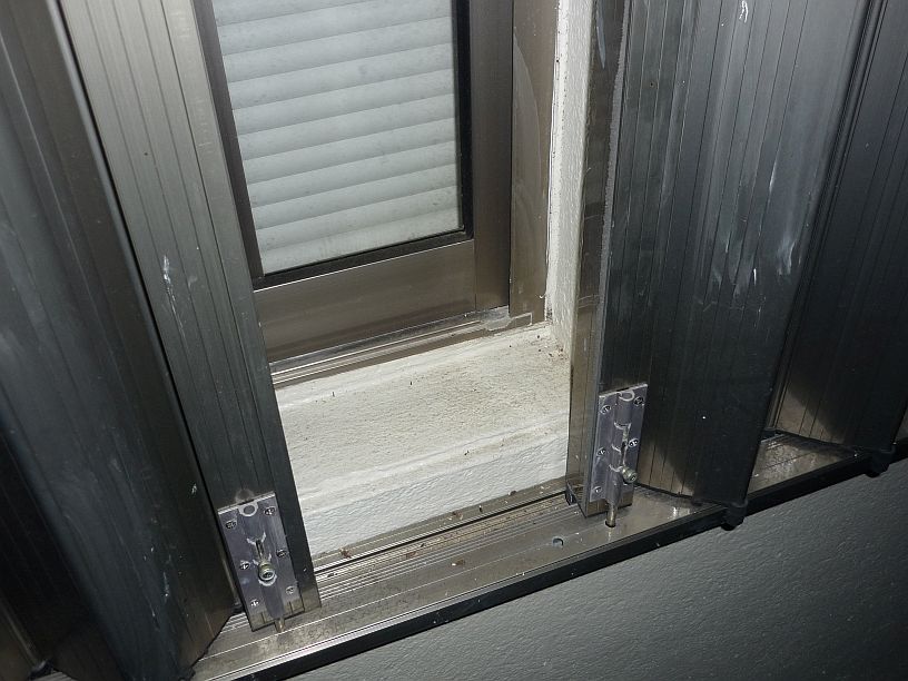
Next on the agenda was to close all the typhoon shutters all six windows.

The shutters are held closed by deadbolts at the top and bottom.

The shutters are held closed by deadbolts at the top and bottom.

The shutters over the windows are closed, now to close the shutters over the door.

The shutters over the windows are closed — now to close the shutters over the door.

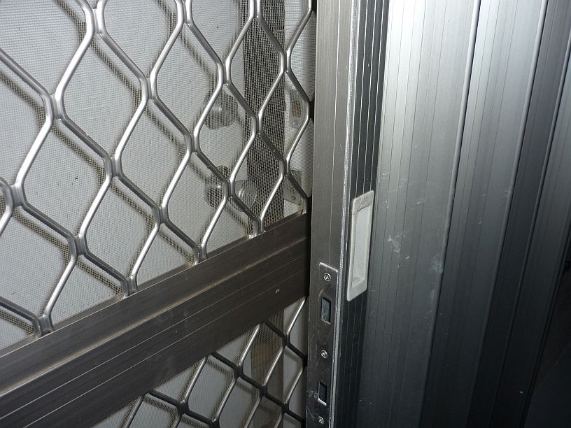
Lastly, we tried to close the shutter on the front down, but found a problem!  The screen door is between the shutter and the front door.  The shutter could only be closed from the outside!  That is not problem, if you are living on the ground floor, because you can close the shutter from the outside and get back in through the back door.  That is not an easy to do when our apartment is on the second floor.

We have a problem!  The screen door has to be open to close the shutter from the inside.  Not possible!

We have a problem! The screen door has to be open to close the shutter from the inside. Not possible!

After investigation, I discovered that the screen door is designed to lift off its hinges.  Another problem — the plaster around the door was done in such a way that the screen door could not be lifted high enough to get it off its hinges (maybe the hinge pins will need to be shortened for future storms). To still have this problem, this apartment complex was probably built after the last typhoon that occurred 12 years ago.

Since this is only a tropical storm and not a typhoon and we should not experience storm surge, especially on the second floor, we decided to leave the door shutters open.

The Lord provided a beautiful sunset this evening before the coming storm.

The Lord provided a beautiful sunset this evening before the coming storm.


2014/07/10 — Thursday

Not a lot to report for today and, sorry, NO photos!

Here are a few things that were done:

1. Advised Mike about the various possible options of obtaining  a spare DVR2000E+ regulator for the standby engine from Ebay.  The Plus version has a digital readout which can be fine tuned more easily and it can be set up on the bench.  The DVR2000E has to be set up, and adjusted, in the extremely noisy environment of a running engine.

2.  Cleaned the rust off the drive spline of the servo that we removed and repaired yesterday.  The servo was then returned to the stockroom.

3.  Helped in the shop with preparing the piping for the first connection from an antenna switch to the overhead line installed earlier in the week.

Jim invited several of us to have dinner with him at Denny’s this evening.  Virginia and I rode with Joel and Joanna for the 13 mile trip to Tamuning and met Jim there.  Phil and April were the only other ones able to be there.  We had a fun evening together and came home stuffed.