We learned that the tropical storm Neoguri that passed over the Independence Day weekend is now strengthening to super-typhoon status and heading toward Japan. Last night, two men drowned off the pier in Merizo (less than a mile down the hill from the TWR Guam transmitters) when their boat capsized in the rough waters remaining from the storm. One of these men was the Merizo mayor’s nephew. Two others in the boat survived.
I worked with Mike this morning to determine the source of occasional momentary audio drop-offs on one of the transmitters last night. Eventually a reset of the computer that controls that transmitter’s programming seemed to solve the problem.
Next, Mike wanted me to try to repair a failed power supply for the Thompson transmitters, which had been replaced with one from the stockroom. Unfortunately, there is no schematic for it, which makes troubleshooting rather difficult. Fortunately, there as a couple other working spares.
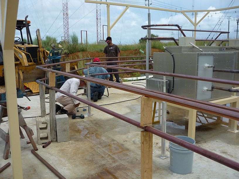
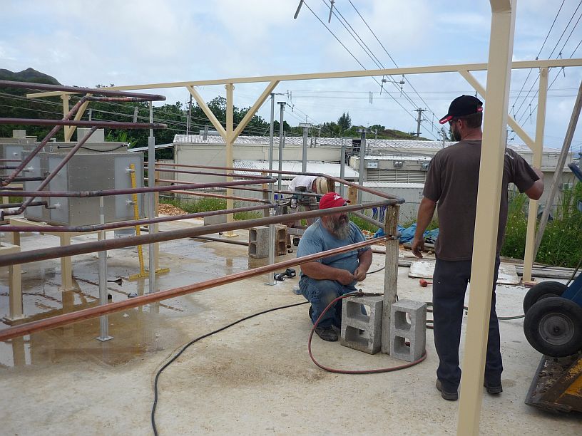
Before making any progress on the power supply, the delivery truck arrived with the support structure for the solar panel array. Photos are below: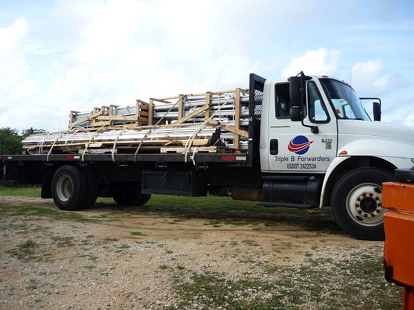

Some minor damage was noted on a couple of the longer mounting rails, so I took photos before they were unloaded. This photo shows the most serious of the damage, which can probably be easily repaired by TWR’s welder, Jim.

Jim unloads the support frames for the solar panel array. Phil and the truck driver are also in this photo. It was necessary to be very careful to keep from getting the forklift stuck due to all the rain over the weekend.
Shortly after unloading the solar array support structure, the post office called to say that the package with the regulator for the standby power supply had arrived. This small Merizo post office is so good about informing the station when packages come in the TWR post box.
When the regulator arrived on site, I began studying the enclosed manual to determine how to set it up. The old, now obsolete, regulator required little setup. This one had all kinds of digital settings that required adjustment before putting it into operation. While I researched the manual, Jim, Joel and Paul concentrated on enlarging the access hole and drilling new mounting holes in the alternator control box to accommodated the new regulator.
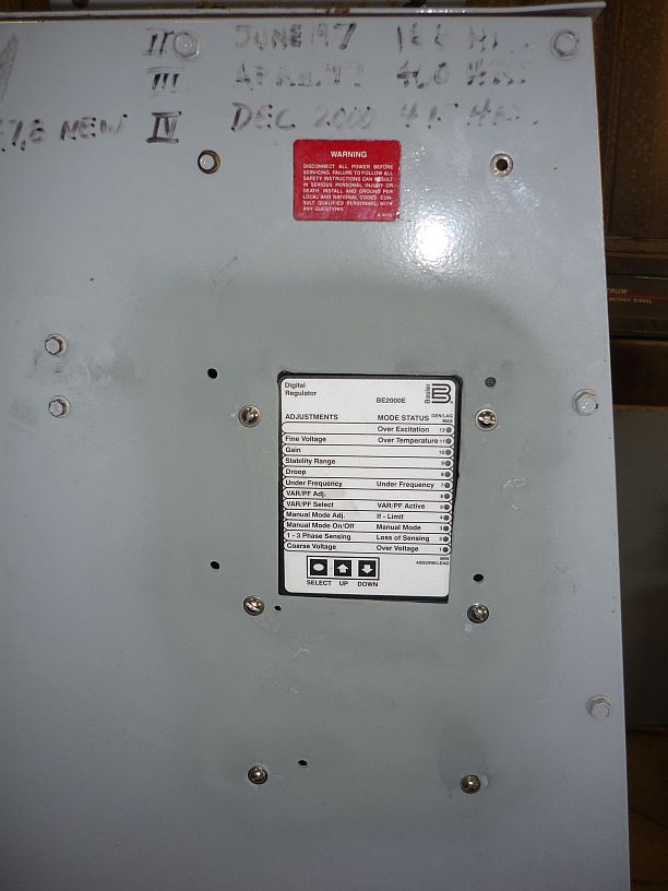
The new regulator now mounted in the side of the control box on the alternator.

After wiring the regulator, the engine was started with only the internal permanent magnet generator connected. This provided the needed 200 volt 300 Hz power to program all the regulator settings, before bringing the power plant on line.
After installing, wiring and programming the regulator, the remaining wires and circuit breakers were properly connected. The engine was again started and meters showed that it was generating the required 480 volts at 60 Hertz. We then transferred the load of the site onto the engine for a few minutes for its final test.
We left the site this afternoon with a sigh of relief that there will be standby power available, in the event of a power line failure, and praising the Lord that there had been no major power failure during the time the standby was out of service, even during tropical storm Neoguri!!


![The dancing got lively when the Tahitian Dancers took the stage! [Virginia too this photo]](https://mcguirereport.mcguireclan.org/wp-content/uploads/2014/07/140706-TahitiDancers.jpg)